 Isaac Gallman
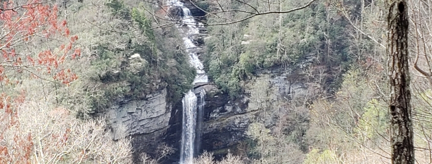
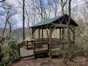
As a native son of the Upstate, Frugal staffer, Isaac knows a thing or two about local trails. One of his favorite hiking destinations is Raven Cliff Falls. If you’re looking for an easy hike with picturesque views, Raven Cliff Overlook Trail is a great choice. The terminus of this gentle 3.8 mile out-and-back is a lovely pavilion that provides sweeping views of the falls. It makes for a great picnic spot.
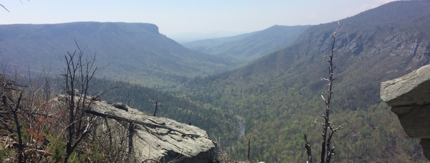
Feeling a little more adventurous? You can get in a full day of hiking by adding a 5 mile loop to your hike. This is a challenging trail so we recommend trekking poles, sturdy hiking shoes, plenty of water, and a backup filtration or purification method.
Difficulty: Moderate/Hard
Length: 3.8 miles/7.7 miles
Directions: From Greenville, head NW on 276. One mile past the entrance of Caesars Head State Park you will see a parking area for Raven Cliff Falls. The red-blazed trailhead is directly across the street.
From the trailhead follow Raven Cliff Trail (red blaze) for 1.9 miles just before you reach the overlook. If you’re sticking with the shorter trail, enjoy a picnic and peaceful views, before heading back the way you came.
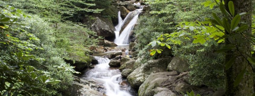
If you’re continuing on, turn left to Dismal Trail (purple blaze) to start a 2k ft decent into the valley. Dismal Trail is 1.5 miles long and ends at Nature Land Trust Trail. Once you’ve reached the bottom, turn right onto Nature Land Trust Trail (pink blaze), and start heading back uphill. This section of the loop is especially enjoyable as it follows the river until you reach huge rock ledges that you walk beside the rest of the way to the falls. This part of the trail for approximately 2 miles. The hike uphill is a little more technical than Dismal Trail with ladders, large rocks, and high steps.
You will know you’re done climbing when you come to the falls and cross a suspension bridge over it. Shortly afterwards, you’ll come to another fork where the Nature Land Trail ends at Gum Gap Trail. At the fork turn right onto Gum Gap trail (blue blaze). It is well maintained without too much elevation gain or loss. It’s a super easy 1.5 mile hike back to Ravencliff Falls trail. Make sure to follow the blazes. The trail runs straight onto an unmarked logging road that you could easily mistake for trail. Stay left onto the blazed path, and continue another mile to the parking lot you came from.
 Maggie Caswell