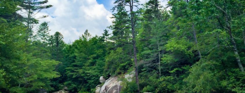
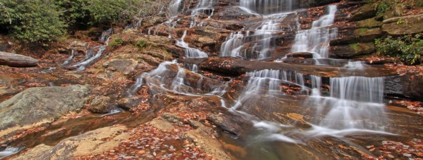
The etymology behind Graveyard Fields is somewhat smoky. Centuries ago massive wind storms uprooted a once prominent spruce forest in this 5,000’ high, hanging valley. Root balls from the uprooted trees slowly decayed and overtime left behind mounds of dirt, similar to those found in ancient burial grounds. In more recent history, 1925 to be exact, a raging fire swept through Graveyard Fields. The fire destroyed everything in its path, including necessary nutrients in the soil. The high valley was left as a smoldering swath of land with “headstones” – the charred, stumpy remains of the spruce forest – strewn about the landscape.
What Makes It Great
Over time, leading up to the present day, Graveyard Fields has slowly recovered from its smoldering past to become a high altitude valley teeming with plant life. Today, visitors to Graveyard Fields will enjoy a mixture of Rhododendrons, Mountain Laurels, Blackberry and Blueberry bushes, high country grasses, and bouquets of wildflowers. Although the Fields have begun a long healing process their integrity is challenged annually by Graveyard Fields resounding popularity and all the inherent issues related to overuse by the outdoor community.
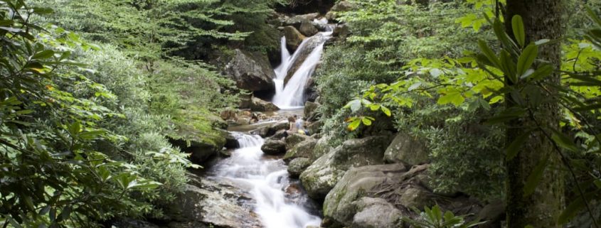
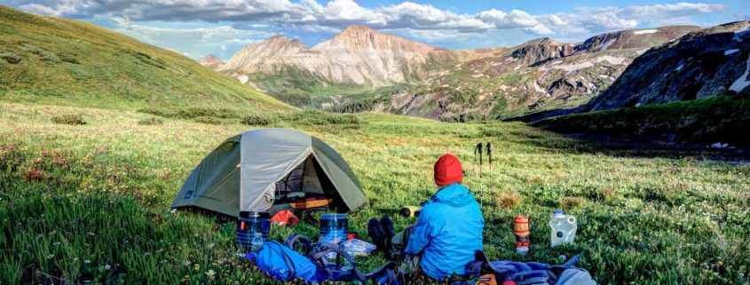
Visitors to Graveyard Fields can enjoy its splendors by way of a newly renovated trail system which includes elevated boardwalks, an intricately integrated bridge across Yellowstone Prong, and an expertly constructed waterfall overlook at Second Falls. Trails within Graveyard Fields can be combined to form a 3.2-mile loop which meanders through the relatively flat valley and includes views of Upper Falls and Second Falls. A detailed trail map sign stands at the parking lot, take a picture to reference later and begin your travels in either direction. Traveling the loop in a counterclockwise direction gives explorers an immediate reward, just .3 miles in, where a wooden staircase leads to the plunge pool below Second Falls. After returning to the start of the staircase the trail continues to wind through the high valley which is enclosed by the towering massif of Black Balsam Knob. As you work your way up the valley, beside a calm section of Yellowstone Prong, you will come to a signed trail leading to Upper Falls. Take this trail for a better chance of seclusion and a glimpse of Upper Falls.
Who is Going to Love It
Visitors in early Autumn will be treated to a dreamlike landscape, covered in the colors of Appalachia, and rich with ripe blueberries! The National Forest Service allows visitors to pick up to one gallon per person so bring a container and gather your fill. Summertime visitors can take advantage of the cooling waters of Yellowstone Prong in the plunge pool at the base of Second Falls. Savvy adventurers may even be able to find the picturesque Yellowstone Falls, just below Graveyard Fields, off of the Mountains-To-Sea Trail.
Directions, Parking, & Regulations
Parking for Graveyard Fields can be found at mile 418.8 on the Blue Ridge Parkway. A recently constructed solar-powered restroom facility sits in the parking lot which has 40 spots. If the parking lot is full venture to nearest overlook and make the trek back to Graveyard Fields. Fair warning, parking in the grass on the side of the road will likely earn you a citation on busy days!
Camping is allowed in several established sites within Graveyard Fields and dogs are welcome but must be kept on a leash at all times.
DuPont State Recreational Forest is a beautiful 10,000-acre outdoor playground in the Blue Ridge Mountains. With roughly 80 miles of multi-use trails meandering through dense forests, alongside mountain lakes, and next to cascading waterfalls, DuPont is a hiker’s paradise.
What Makes It Great
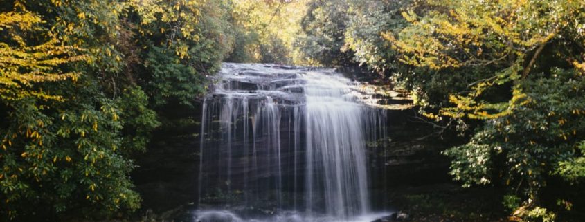
Options are something you’ll have plenty of in DuPont. The 4.5-mile trail to Cedar Rock is a wonderfully scenic route with excellent views and not too much strenuous elevation gain. Both the short and long routes to the summit of Stone Mountain- the tallest point in DuPont- are grueling hikes with steep grades, yet amazing views. And hiking alongside one of the five lakes within DuPont is always a pleasant experience, most notably the 99-acre Julia Lake. But perhaps what DuPont State Forest is most known for is its waterfall hiking. The Little River flows through the park and creates four waterfalls on its way. Hooker Falls, Triple Falls, High Falls, and Bridal Veil Falls are all worth seeing, and you can actually reach three of these in one fell swoop on an easy 3-mile route. By parking at the Hooker Falls lot, you can reach the 12-foot cascade of Hooker in a matter of minutes, followed by a 1/2 miles jaunt upstream to the impressive 120-foot cascade of Triple Falls, and finally another 1/2 walk to the grand finale of 150-foot High Falls. After you’ve had your fill, simply turn around and return from where you came.
Who is Going to Love It
No matter what adventure you choose to have in the DuPont State Forest, it’s sure to be quite memorable for any nature lover. Oh, and movie lovers, a few scenes from “The Hunger Games” were filmed here, so that’s just the cherry on top.
Directions, Parking, & Regulations
From the DuPont State Forest website: “Take I-26 east toward the Asheville Airport. Exit at the Airport (exit 40) and head south on NC-280 for about 16 miles. Turn left onto US -64 (heading east) for about 4 miles. In Penrose, turn right onto Crab Creek Road for about 4 miles to DuPont Road. Turn right on DuPont Road and continue for 3.1 miles.”
The waters of Yellowstone Prong spring from the peaks of the Great Balsam Mountains and gather themselves in Graveyard Fields. Born from springs above 6,000’ and purified through the 5,000’ meadow, these waters run crisp and clean. The perpetually cool waters flow peacefully through the hanging valley before plunging down a raucous ravine which leads to the Prong’s confluence with the East Fork of the Pigeon River.
What Makes It Great
From the mouth of Graveyard Fields the Yellowstone Prong cascades over the mighty Second Falls and then the secluded Yellowstone Falls. A short distance downstream the Prong makes its most risqué drop over Skinny Dip Falls. At this popular swimming hole a series of cascades and plunge pools line the banks of a heavenly ravine. A short, .5 mile walk from the Blue Ridge Parkway, leads to Skinny Dip falls where you can cool your body and refresh your soul in the wild waters of Appalachia.
Access to Skinny Dip Falls can be found right off the Parkway from the Looking Glass Rock overlook. Across the Parkway, from the overlook, a blazed spur trail leads into the woods. After taking this trail and entering the woods you will notice an Indian “Trail Tree,” which was formed as a trail marker by indigenous tribes. Perhaps they also enjoyed taking a dip, skinny style, in the Yellowstone Prong? After passing the ornate tree – some say the face of a dragon can be seen in its gnarled bark – hikers will come to an intersection with the Mountains-To-Sea trail. Veer left at this intersection and follow the rocky trail until reaching the swimming area. When you reach a wooden staircase leading to a bridge spanning the creek, you have arrived!
Enjoy yourself in the series of plunge pools, but please keep your clothing on if there’s a crowd. The falls are Skinny Dip by name only, not by nature during busy hours. A grouping of Boulders along the right side of the upper pool provides a platform to jump into the 6’ deep water. Use caution and make sure to hit your mark if you decide to take the leap off of the 8’-10’ rocks. The lower pools of Skinny Dip Falls are serenely beautiful and offer wading and lounging opportunities on their sun-soaked rocks.
Who is Going to Love It
Thanks to such easy access Skinny Dip Falls has become a highly popular area for families and adventurers. On warm summer days you are likely to share the water with a crowd. Fear not though, there are plenty of pools to spread the watery wealth. This swimming hole is in the vicinity of some incredible hiking trails. The Art Loeb, Mountains-to-Sea trail, Black Balsam Knob and Shining Rock are all within striking distance. Take a hike, then cap off your adventurous day by soothing your aching muscles in the waters of Skinny Dip Falls!
Directions, Parking, & Regulations
From Asheville catch the Blue Ridge Parkway near our Diamond Brand Outdoors’ South Location. Pick up your last-minute supplies there and then head south on the Parkway towards the Looking Glass Rock Overlook, located by mile marker 417.
Parking here is free but you may want to get there early on pretty summer days to find a spot.
Dogs are welcomed but should be kept on a leash until they are ready for a swim!
Early settlers who ventured into this tract of land found it so wild they referred to the main valley as “a town of painters.” This town of painters – an ancient Appalachian term for Panthers – has vocally transformed into the modern-day Panthertown Valley. Panthertown’s land has switched hands many times over the years. During the 1920’s a symphony of axes, saws and dynamite-filled the valley as loggers harvested virgin timber. In the 1960’s Liberty Life Insurance purchased the Valley; intent on damming the Tuckaseegee to create a lake resort. Those plans never came to fruition. Lucky for us, the U.S. Forest Service acquired the land in 1989 and placed it under the jurisdiction of the Nantahala Ranger District.
What Makes It Great
Today the valley is home to an intricate network of trails which wind through Panthertown’s unique landscape. Hundreds of millions of years ago forces within the Earth melted mountain d rocks which later cooled and hardened into mountainous “granite plutons”. Over many millennia the forces of erosion have rounded and revealed these towering monoliths within Panthertown Valley. The Valley’s trail system leads visitors by the bases of and to the tops of these rounded cliff-sides.
The Valley has become a popular destination for hiking, biking, climbing and horseback riding. Regardless of the crowds, an escape to serenity is little more than a footpath away in Panthertown. The Forest Service maintains a network of signed trails which most people will instinctively follow. In addition to these “hiking highways,” a labyrinth of unmarked and unnamed “faint-paths and foot-trails” have been developed over the years by a wily group of local enthusiasts.
Venturing out on these lesser known trails can be exhilarating and empowering, but sometimes just plain dangerous. Pick up a copy of A Guides Guide to Panthertown, by longtime Valley enthusiast Burt Kornegay, bring your compass and GPS, mark your divergences, and then go explore!
Who is Going to Love It
Panthertown’s terrain has created a land of waterfalls which plummet raucously over laurel lined rock faces. Between falls these creeks meander slowly through groves of luscious growth along the valley bottom. Tannins from decaying vegetation in the bogs stain the waters of Panthertown an intriguing tea-color. Sandy beaches and water-carved plunge pools, line the creek banks and offer a reprieve from sweltering summertime temperatures. Come to Panthertown in the heat of the summer, bring your swim gear and take advantage of all the aquatic opportunities in the Valley.
Venture out on the Greenland Creek Trail; work your way up the Creek to see three waterfalls on your way to Tranquility Point, atop Little Green, where you will gain an expansive view of the valley!
Explorers can gain access to the East side of the Valley from Salt Rock Gap Trailhead. Take the Panthertown Valley Trail for a quick viewpoint from Salt Rock, then continue down into the valley to soak up the sun’s rays at the Sandbar Pool!
There is no fee to visit Panthertown Valley and many established backcountry sites are available. Dogs are welcomed but be bear aware, and practice Leave No Trace principles on your visit.
The Boone Fork Trail is renowned not only for the sultry beauty of the mountains it passes through but also the range of ever-changing terrain that one will encounter on this dynamic five-mile loop. The hike begins and ends in Julian Price Memorial Park, a swath of land comprised of 4,200 acres of dense hardwood forest and rolling Appalachian Mountains.
The trail’s namesake river, the Boone Fork, will intersect your path at multiple points along the way, but never with the same temperament. It firsts appears as a flat and docile stream, then transforms over the next few miles into a roaring cascade, tumbling through a garden of cracked granite boulders. As you near the completion of the trail, the river once again becomes placid, cutting through floodplains that, in the summer months, are choked with wildflowers.
Your hike will begin with a gentle climb through soft, undulating hills that give way to cow pastures, meadows and marshes as the din of the river grows and fades in the background. In the heat of summer, you will be grateful for chilled rhododendron tunnels and tall, shady coniferous trees. The gradient for the majority of the trail is moderate, making it a popular loop for trail runners. A few moments of steep climbing, timber cut steps, and one wooden ladder may present a challenge to children, small dogs, and anyone not dressed for the slippery and uneven terrain. Other obstacles include rock hopping, stream crossings, and brief sections of mud.
The pinnacle of this hike is Hebron Rock Colony, a jumble of flat-top boulders so thickly dispersed that the river all but disappears beneath them. This unusual feature cuts into the hillside like an ancient highway, providing an idyllic spot for sunbathing and picnicking. In certain areas, water splashes over granite tongues, creating a natural water park that will prove irresistible on sweltering summer days.
Farther along the trail, rock outcrops provide views of iconic Grandfather Mountain and Hanging Rock. Long range mountains views are secondary, however, to the immediate splendor of a lush, river-fed landscape, wide open fields, and waist-high wildflowers. Not long after embarking from the parking lot, you will find yourself feeling completely immersed in an ethereal beauty reminiscent of a watercolor painting.
Although swimming spots and sunny meadows make this hike a popular excursion in spring and summer, Boone native Ambrose Park advises paying a visit in the offseason as well.
“The Boone Fork trail is awesome, but in the summer you run the risk of crowds,” says Park, warning that on weekends he’s seen people forfeit their hike because they couldn’t find a parking spot. “I like to run it in the fall when there are fewer people and all the colors, and in the winter the river forms all sorts of enchanting icicles.”
To access the trail, cross the footbridge at the Price Park Picnic Area, mile marker 296.4 in Julian Price Memorial Park. Allow yourself three hours of daylight to complete this hike.
After a few days in the great outdoors, the last thing you want to do when you finally get home is tackle the task of cleaning your gear—we get it. But, as any outdoor enthusiast knows, gear is pricey stuff—and that’s if you buy it once. However, putting in just a little bit of time and effort into keeping your gear cleaned, fixed, and stored properly has big impact on its lifespan and performance.
Fortunately, many wear-and-tear issues can be eliminated with proper maintenance and storage, and most damage can be addressed without replacing the item. By getting into a “Repair > Replace” mindset, you’ll save money and be more environmentally friendly. Your used gear is already part of the waste cycle, and by repairing instead of replacing, you’re reducing the carbon output of the manufacturing process.
We’re stoked to see brands jumping on board with this. From Osprey’s All-Mighty Guarantee to Patagonia’s Worn Wear initiative, eco-conscious brands actually encourage customers to repair their gear. A great place to start is your local gear shop for a variety of repair kits, including waterproof patches, hammock and tent kits, seam tape, and more. And, if it’s a bigger fix you don’t feel equipped to handle, many brands have a warranty repair program.
Fortunately, you don’t have to be an expert to keep your gear in good working order; it just takes discipline and know-how. Here are some insider tips on how to clean, repair, and store your big-ticket items, which will keep more money in your bank account and raise your dirtbag cred at the same time.
Tents
Your tent is your home away from home; treat it with some extra TLC to keep it functioning well.
Cleaning: Before breaking down your tent, pick the whole thing up and shake it out, removing potentially abrasive debris. For a more thorough cleaning at home, set up the tent and wipe down the fly and body with a diluted mixture of hand soap and warm water. Never use detergent or put the tent through the washing machine—it can damage any protective coatings.
Repairs: Silnet is a great product created specifically for treated nylon products like tents. It works like Super Glue and can be used for seam reinforcement or to fix pinhole tears. Small rips in the mesh can be repaired with mesh repair patches, which have an adhesive that allows you to fix the tear without a sewing kit. Clean fabric with rubbing alcohol beforehand, allowing sufficient drying time, to help the patches stay in place.
Storage: The first rule of thumb: Always store your tent flat and clean! Resist the urge to crumple it into the bottom of a stuff sack. Yes, it’s so easy to let camping gear get strewn everywhere after a trip, but take the time to lay your tent out and fold it along the seams, where it’s least likely to crack, and you’ll improve its lifecycle.
Down Jackets and Sleeping Bags
Cleaning: Experts recommend washing down items at least every season, which helps maintain the loft and warmth-to-weight ratio. Find a front-loading machine (the agitators in top-loading machines can damage the fill) and wash on a gentle, cold cycle with a small amount of down-specific wash. It helps to add a few other items in the machine to balance the spinning. Tumble dry on a gentle setting, checking often—if the dryer gets too hot, the face fabric can melt. When the item is nearly dry, add a few tennis balls to the dryer to break up any clumps of fill.
Repairs: A small tear in the face fabric shouldn’t be the end of a jacket or sleeping bag. Take a glance around any group of outdoorsy folks, and you’ll see gear decorated with patches of duct tape, which is all it takes to fix a small tear.
Storage: Always stash your down items at their highest loft possible, which means don’t compress them into tight bags for long-term storage. Leaving down compressed can degrade the loft and creates weakness in material treatment. Upon returning from your trip, remove the sleeping bag or jacket from its stuff sack and shake it out. Your sleeping bag likely came with a large mesh or lightweight bag—perfect for storage. If you don’t have the original, you can find one online or at a local gear shop.
Rain Gear
Cleaning: Rain gear needs to be washed a few times per season, especially gear with an ePTFE membrane. ePTFE is an expanded plastic membrane with 9 billion pores per square inch. This technology creates a waterproof, breathable layer that prevents water drops from saturating, but allows the vapor to leave. ePTFE—utilized in garments listing Gore-Tex or eVent—is oleophobic, which means oils from your skin can clog the microscopic pores and cause the jacket to lose breathability. No matter what the waterproofing, rain gear has a Durable Water Resistant (DWR) treatment on the face fabric, and residue from campfires and other contaminants can reduce the effectiveness of the coating. Washing garments with mild powder detergent or a tech wash will revive it.
Repairs: Feel like your older raincoat is losing waterproofing? Make sure you’re not just sweating it out—the jacket might just need to be washed. Second, check along the seams. If you find a seam failure, a product like Seam Grip can come to the rescue. For small tears on the face fabric, a patch kit from the manufacturer or your local gear shop will do the trick. To revive an older garment, give it a DWR treatment and it’ll feel nearly good as new.
Storage: Store your rain gear out of direct sunlight, preferably hanging up and not crumpled. This will help prevent the laminates from cracking. And it should go without saying, but never shove the jacket into the closet when it’s still wet, which breeds mildew and other funky, damaging stuff.
Hiking Boots
Putting some effort into taking care of your hiking boots means they’ll really go the distance on the trail.
Cleaning: While much of the backpacking world is migrating to synthetic trail shoes, leather hiking boots still hold a corner of the market. Keep yours clean and supple by scrubbing dirt off with mild soap and an old toothbrush, and treating with a leather cleaner every few months. Never put boots through the washing machine.
Repairs: If your waterproof boots are wetting out, apply a waterproofing agent, following the package instructions. If the outsole is beginning to separate, it might be a job for your local repair shop, or you can try to DIY by applying an adhesive like Shoe Goo.
Storage: When it’s time to put away the boots for the season, clean them thoroughly before storing them, removing all caked-on dirt. If the midsoles are removable, pull them out to allow ventilation.
Backpacks
Cleaning: Have you ever given your backpack a thorough cleaning? Probably not, which means the straps are caked with sweat, the bottom is filthy, and something spilled inside at least once. Hand wash the pack in the tub with mild hand soap, turning it inside out and scrubbing inside every pocket. If you run the pack through a front-loading washing machine, place it in a pillowcase to avoid getting the straps and buckles caught. Always air dry—dryers can wreak havoc on the synthetic material, zippers, and other features.
Repairs: There are a lot of things that can go wrong with a pack, and most don’t warrant a full replacement. Torn mesh, broken zippers, failing buckles, and fabric tears are all replaceable or easily fixed. Gear companies will likely send you the exact strap or buckle you need, and many will stitch mesh or fabric back together. Your patched-up pack will have way more personality.
Storage: This one’s easy. Just store the pack clean without anything nasty caked to the inside.
Skis
Cleaning: If you choose to wax your skis yourself, you probably have a good idea of what you’re doing. In short, you’ll clean up the edges with a diamond stone, apply a coat of wax with an iron, let it cool, then thoroughly scrape it from tip to tail with a scraper. Brush with a brass brush, then polish with a fiber pad. Not sure how to do it? Watch a video or ask someone at a ski shop before tackling it for the first time.
Repairs: Take care of any dings right away—minor damages to the base can be peeled off with a sharp knife to prevent catching and dragging. The gouge can be patched later.
Storage: Clean and dry your skis, and take care of any minor burrs that could result in rust. Store skis upright, preferably in a rack out of direct sunlight.
Climbing Rope
Your climbing rope is a critical piece of gear; make sure you take care of it properly.
Cleaning: Self-preservation means keeping load-bearing (i.e. life-saving) gear in peak condition. Keep as much dirt off the rope as possible by flaking it on a rope bag or tarp when climbing outside, and never step on it. When your rope gets dirty, wash it with warm water and a designated rope wash and rope brush, feeling for soft spots, which can mean that section is core shot. Rinse thoroughly until the water runs clear. Hang the rope in large loops over a railing to avoid annoying pigtails as it dries.
Repairs: The best way to repair a rope you’re unsure about is to not repair a rope you’re unsure about. Don’t risk it. Turn it into outdoorsy home decor by making a lovely rug.
Storage: After thoroughly cleaning and drying your rope, flake it loosely into a rope bag or tie it into a butterfly coil. Store in a cool, dry place out of direct sunlight. When you take it out for the first use of the season, check the entire length up and down for soft spots.
https://frugalbackpacker.com/wp-content/uploads/2018/07/qy2ks9pfxkqaxqwgnlrk.jpg6371044Frugal Backpacker/wp-content/uploads/2016/04/frugal-backpacker-logo.pngFrugal Backpacker2018-07-23 18:30:002018-07-31 18:28:24Keep Your Gear Like New: Cleaning, Repair, and Storage Tips
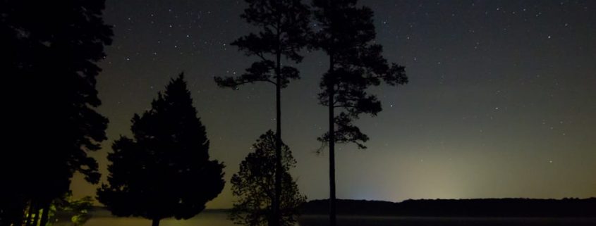
When you live near a city it can be easy to forget just how many stars are in the night sky. But if you take the time to get away from the light pollution, spread out a blanket, and look up, there are more to see than you can imagine. It’s relatively easy to find a dark sky out west—what about in the southeast? Where can you escape the city lights and find a truly dark sky for stargazing? Here are six of the best places in the southeast to take in the majesty of the night sky.
Before you head out, read this quick guide so you know what to expect and what to look for up there.
1. Staunton River State Park in Scottsburg, Virginia
Find your favorite constellations at Staunton River State Park.
Designated a Dark Sky Park in 2015, Staunton River State Park is just 25 miles from the North Carolina border and sits between the Dan River and the John H. Kerr Reservoir. There are plenty of opportunities for fishing, swimming, and hiking, but the real draw is once the sun goes down. The park rangers host interpretive programs and there are telescopes available to rent—or you can just show up with your blanket. Bring a tent and spend the night at the park’s campground or rent one of the historic cabins built by the Civilian Conservation Corps in the 1930s.
2. Blue Ridge Observatory and Star Park in North Carolina
The Milky Way blazing from the Blue Ridge Parkway.
If you’ve ever driven along the Blue Ridge Parkway, you know it’s some of the most beautiful scenery in the United States. But if you haven’t seen it at night, you’re missing out on the real magic! The Star Park is located in the Appalachian Mountains in Burnsville, North Carolina, and is managed by Maryland Community College. Surrounded by the Pisgah National Forest, it’s an experience that you won’t soon forget.
Note: there is no camping allowed in this park.
3. Portsmouth Island, North Carolina
The Outer Banks in North Carolina is already a decent spot for stargazing, but if you’re serious about checking out the Big Dipper, head to Portsmouth Island. The 13-mile-long island is just south of Ocracoke Island, making it the southernmost in the chain of barrier islands. The only way to get there is by boat and there is plenty of fishing, shelling, and exploring to keep you busy during the day. Set up camp pretty much anywhere you want, and enjoy the peace and tranquility of one of the wildest islands in the Outer Banks. Facilities and amenities are very limited so make sure you are prepared before taking a trip out to Portsmouth.
4. Obed Wild & Scenic River in Wartburg, Tennessee
You might be familiar with the Obed Wild & Scenic River because of all the outdoor adventures to be had here, but what you may not know is that it’s also a newly-designated (2017) Dark Sky Park. The National Park Service regularly hosts night sky outings and the Knoxville Observers and ORION Astronomy Clubs also host astronomy programs in the area. The park service offers a Junior Ranger Night Explorer program, making this spot particularly family-friendly.
The park staff is also working to keep the sky around the Obed dark by prohibiting any permanent outdoor lighting.
This 80-acre park might not cover a large space, but it does offer the unique opportunity to go stargazing in the Okefenokee Swamp, the country’s largest blackwater swamp. Stephen C. Foster State Park is part of the Okefenokee National Wildlife Refuge, so you can’t stay overnight, but the park is open until 10 p.m., which gives you plenty of time to get your stargazing fix. Sign up for the Swamper’s Guide to the Galaxy, a Constellation Cruise, or a Paddle Under the Stars to learn more about what you can see in the sky—and in the swamp!
6. Pickett CCC State Park and Pogue Creek Canyon State Natural Area in Jamestown, Tennessee
This state park lies within the Pickett State Forest in the Cumberland Mountains and is very close to the Big South Fork National River and Recreation Area. This means there’s a whole lot of nature and not a lot of light pollution. The area earned its Dark Sky Park designation in 2015, and the staff host several night sky programs in the summer. The park has regular campsites, group campsites, and cabins you can rent and stay for a whole weekend of stargazing.
https://frugalbackpacker.com/wp-content/uploads/2018/07/zctio0andtdsiebem3dz.jpg6961044Frugal Backpacker/wp-content/uploads/2016/04/frugal-backpacker-logo.pngFrugal Backpacker2018-07-23 16:30:002018-07-31 18:28:446 Best Stargazing Spots in the Southeast
Across the Great Smoky Mountains National Park, miles of interconnected trails meander through lush, green valleys, hug the banks of moss-laden, rocky creeks, and climb through thickets of mountain laurel and rhododendron to the blue-tinged mountain peaks.
You could spend weeks backpacking through this rich landscape, but a weekend trip will also allow you to experience the best of the Smokies. To help you plan your visit, we’ve highlighted three backpacking loops that give you the Appalachian Trail, streamside and ridgeline campsites, killer views, and enough distance and elevation to satisfy your inner weekend warrior.
Big Creek Loop
Combining the best of front-country and backcountry camping, the Big Creek area on the northeastern tip of the park off I-40 offers something for every level of hiker. Tackle a 21.5-mile loop over big peaks or lower your mileage and elevation with a night at one of the sweetest creekside campsites in the park. Either way, you’ll hike the AT through some of the most scenic terrains in the Smokies.
You will be in constant awe of the beauty on Big Creek Loop.
Roll into Big Creek Friday night to enjoy campground amenities like restrooms, dinner at a picnic table, and campsites with fire rings. You’ll be up early on Saturday to climb the Chestnut Branch Trail 2 miles to the Appalachian Trail. One of the shortest AT access points, the trail passes the remains of homesteads that pre-date the national park.
Turn south on the AT and continue climbing 3.3 miles to the 0.6-mile Mt. Cammerer fire tower spur trail. At 4,928 feet, the tower overlooks the Pigeon River Gorge to the north and Mt. Sterling to the south. From the fire tower, it’s a moderate descent 2.1 miles to the Low Gap Trail. Take Low Gap 2.5 miles to campsite #37 at the Big Creek Trail junction. Right on the banks of Big Creek, you’d be hard pressed to find a more spacious backcountry site in the park.
On Sunday, you can go big or go home, as they say. Going big means a hike up the Swallow Falls Trail 4 miles to the Mt. Sterling Ridge Trail. It’s another 1.4 miles and more climbing to an elevation of 5,842 feet on Mt. Sterling. Climb Sterling’s 60-foot steel fire tower for panoramic views of Cataloochee Valley, the Black Mountains, and the Southern Appalachians. Now, the downhill endurance test begins, with a 4,000-foot elevation loss over 6 miles on the Baxter Creek Trail. If you opt to go home, you can sleep in, savor your coffee by the campfire, and still have plenty of time to hike the moderate, 5-mile descent along Big Creek back to the campground, passing two stunning waterfalls and plenty of swimming holes along the way.
Big Creek loop ends with a 4,000-foot elevation loss over 6 miles on the Baxter Creek Trail.
Big Creek Campground is open from April through October and makes a great base camp for groups by serving a wide variety of abilities and interests. On your way home, make sure you leave enough time to refuel at Carver’s Apple Orchard in Cosby, Tenn. At Carver’s you can shop for fresh produce at the farmers market, nab awesome treats at an old-time candy shop, and feast at a homestyle restaurant, where the apple fritters are not to be missed.
Twentymile Loop
In the southwest corner of the Smokies, you’ll find a lesser-used trailhead that leads to the AT and one of the most scenic balds in the park. From this trailhead, you’ll log 17.6 miles on the way to Gregory Bald, sleeping one night on the AT and camping the other night on the bald.
Start off Friday afternoon at the Twentymile Ranger Station off Highway 28 near the border of North Carolina and Tennessee. A non-technical climb takes you 4.5 miles to meet the AT at Sassafras Gap. Campsite #113, at Birch Spring Gap, is less than 1 mile north of the trail junction. If time allows late Friday or early Saturday morning, head south on the AT for 360-degree views at sunset or sunrise from the top of Shuckstack Fire Tower. The historic lookout isn’t regularly maintained, so watch your step on the 200-foot climb to the top.
In the southwest corner of the Smokies you’ll find the lesser-used Twentymile Loop trailhead.
You’ll resume your northward journey on the AT, traveling 2 miles over Doe Knob to the next trail junction. Next, take Gregory Bald Trail west a little more than 3 miles to campsite #13 on the bald. Known for spectacular flame azalea blooms each year in mid to late June, the grassy high-elevation meadow offers stunning views of Cades Cove, Fontana Lake, and Clingmans Dome.
On Sunday, make the final 6.3-mile descent to the trailhead on the wide, non-technical Wolf Ridge Trail. Refuel at Fontana Village, just over 6 miles down Highway 28, before heading home. Burgers and brews will hit the spot at Wildwood Grill, while the Mountainview Restaurant highlights seasonal produce, along with fresh, local rainbow trout.
Deep Creek Loop
Along Deep Creek loop you’ll pass Indian Creek Falls.
Enjoy the streams and waterfalls of the Deep Creek area in the south-central region of the Smokies on this 28.2-mile loop. You’ll also spend a night in an AT shelter and exit on one of the longest continuously descending trails in the Smokies.
You’ve barely left the Deep Creek Ranger Station before you come across Tom Branch Falls and Indian Creek Falls. Once you pass these Instagram-worthy stops, it’s a slight uphill grade for 4 miles along the moderately rocky Deep Creek Trail to campsites 54-59. Claim a site for Friday evening (all but one are non-reservable) to enjoy the refreshing waters of Deep Creek and thickly wooded campsites.
Creek crossings and easy bushwacking are on the agenda Saturday, as you hike another 4 miles to the Fork Ridge Trail. Fork Ridge ascends 5 miles to Clingmans Dome Road and the AT. A short hike north takes you to the Mount Collins shelter, where you’ll spend the night in a high-elevation spruce-fir forest and dramatically cooler, drier conditions. Enjoy the shelter amenities, like cozy bunks and a fireplace inside.
Hike down from Clingmans Dome Road to start your final 11.4-mile descent.
The pre-dawn hike south to Clingmans Dome is highly recommended for 360 degrees of sunrise from the highest point in the Smokies. Hike 2 miles down Clingmans Dome Road to the Noland Divide Trailhead to start your final 11.4-mile descent. The trail slopes gently for the first 5 miles before making a steeper drop into Deep Creek, but there are few roots and rocks to slow you down. Make sure you stop to enjoy the views at Lonesome Pine Overlook along the way.
After logging all those miles, nothing’s going to taste more satisfying than a meal and craft beer at The Warehouse at Nantahala Brewing Co. Wrap up your Smokies adventure on the outdoor patio in downtown Bryson City with specialties like the slow-cooked brisket noodle bowl, apple bourbon pork chops, or Bryson City Brown Ale chicken along with a flagship or seasonal draft.
The lush and timeless beauty of the Blue Ridge Mountains has appealed to movie producers and location scouts for the last 90 years. In fact, North Carolina has more sound stages and production complexes than any other state outside of California. Many of the movies shot in Western North Carolina were filmed on public lands, and can be explored by hiking, mountain biking, and paddling. Unlike Hollywood studio tours, visiting these wild and remote locations requires no tickets or tour guides–but packing a box of sour patch kids is always a good idea.
Lake Fontana
Lake Fontana
TimothyJ
The deep and placid waters of Lake Fontana lie on the southern border of the Great Smoky Mountain National Park. This reservoir and the surrounding forest was the location for the 1998 drama Nell , staring Jodi Foster as a feral young woman raised in isolation in rural North Carolina.
Much like the haunted and beautiful Nell, the landscape itself feels wild and secretive. The winding, seventeen mile lake is filled with hidden coves and tiny islands that provide a beautiful day of exploration by kayak or paddleboard. A motor boat ride can deliver you to the Hazel Creek Trailhead, one of the most remote areas in the Smoky Mountains National park.
Fishing is another popular activity on Lake Fontana. Because of its frigid temperature, the emerald waters are home to a number of species of fish more typical to Northern lakes.
One of the best ways to explore the area is to ride trails of Tsali, etched into the steep hillside that borders the lake. Two pairs of looping trails are open to mountain bikers on alternating days throughout the week. Rolling, smooth, and zippy, this flowing singletrack is guaranteed to unleash your inner wild child.
Lake Lure
A recreation of the iconic ‘dramatic lift’ scene from Dirty Dancing.
Ken Heine
With its venerated soundtrack and dance moves that started a nation-wide craze, Dirty Dancing is one of the most beloved and enduring cult hits of all time. Everybody knows you don’t put Baby in the corner, but did you know that the movie was filmed on Lake Lure in Rutherford County, in the shadow of Chimney Rock State Park ?
All 80’s pop and overwrought romance aside, this is one of the best natural areas to explore in the Southeast. Lake Lure and Chimney Rock are situated in the Hickory Nut Gorge Wilderness, which features hundreds of trail miles winding through one of the most biodiverse regions in the nation. Climbers can have the time of their life, pun intended, by tackling some of the hundreds of high-quality bouldering lines at Rumbling Bald. To cool off, The Beach at Lake Lure offers all types of summer fun, including side by side waterslides that will deposit you right into the lake.
Fanatics of the film can attend the weekend-long Dirty Dancing Festival at Lake Lure, where you can participate in such movie-inspired events as ballroom dancing, a watermelon toss, walking tours, and even a “dramatic lift competition” to recreate the iconic dance scene.
DuPont State Forest
DuPont State Recreational Forest is an expansive, 10,000-acre tract of wooded land, famous for its abundance of spectacular waterfalls. Many scenes from the 1992 historical epic The Last of the Mohicans were filmed here, as well as portions of the 2012 smash hit The Hunger Games. Both movies are renowned for the eerie and evocative beauty of their natural setting, which you can explore via 80 miles of multi-use trails that zig-zag through the forest.
Hike an easy half mile to the base of Triple Falls to see where Peeta Mellark disguised himself as part of the murky landscape of the fearsome Arena. (Visit on a dark and rainy day to experience the full effect.)
Behind the veil at Bridal Veil Falls
David Clarke
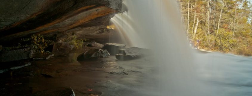
One of the most famous scenes in Last of the Mohicans was filmed at the top of Bridal Veil Falls. It was behind the ten-foot free fall of pounding water that Hawkeye begs Cora to surrender should she be caught, promising to return and find her, “No matter how long it takes, no matter how far.”
You can relive this impossibly dramatic scene by ducking behind the falls and exploring the cave for yourself. Just don’t try leaping out the way Daniel Day-Lewis did–that famous plunge was shot in a studio.
Henry River Mill Village
The historical Henry River Mill Village was the location for The Hunger Game ‘s impoverished coal-mining hamlet of District 12. The poorest district in Panem is actually the remains of a tiny textile village in Burke County. The houses are decaying but remain otherwise unaltered, creating a haunting vision of the past, and, if we are to believe the movie, our apocalyptic future.
Although the town is now under private ownership, you can see it by driving the Henry River Road off the Hildebran exit on I-40. Die-hard fans of the Hunger Games trilogy, and anyone with an interest in the state’s human and industrial history will not want to miss this opportunity, a riveting addition to a day of exploring “The Arena” in DuPont State Forest.
Cold Mountain
The view from the summit of Cold Mountain.
CutOffTies
In the 2003 epic war drama Cold Mountain, a beleaguered Jude Law journeys home through the Appalachian Mountains after deserting from the Confederate Army. Although it was filmed primarily in Romania with a handful of shots in the American Southeast, you can visit the movie’s namesake mountain, located in the Shining Rock Wilderness in the Pisgah National Forest.
Follow an 11-mile (roundtrip) section of the rugged Art Loeb Trail to the summit of Cold Mountain for an all-day epic. This 2,800-foot climb through densely forested wilderness will give you a taste of the ubiquitous challenges that faced W.P Inman on his journey back to Ada. Make sure and bring a map and compass, and, if you’re striving to be authentic to the movie, a small herd of goats.
The Biltmore
The ornate grounds of the venerable Biltmore Estate has been the setting for an enormous array of movies. Ritchie Ritch, Patch Adams, Forest Gump, The Swan, Being There, Mr. Destiny, and Hannibal are only a few of the films that made use of the anachronistic grandeur of the Biltmore Mansion and the 8,000 acres of sprawling, manicured landscape surrounding it.
Western North Carolina is a land of waterfalls. Countless cascades punctuate the waterways braiding the vast expanses of forest and lofty Appalachian peaks dominating the western corner of the state, lending the landscape an undeniably enchanting quality. Some of the falls are accessible only after delving into wild pockets of backcountry, while others are just steps from the state’s tree-lined byways. With the abundance of waterfalls, narrowing down a short list is a formidable of challenge, but these are among the most stunning cascades adorning the western part of the state.
Located just outside the town of Cashiers, in the Nantahala National Forest, Whitewater Falls is one of the most awe-inspiring cascades in waterfall-laden western North Carolina—and it has the notable distinction of being the loftiest waterfall east of the Rocky Mountains. The mighty cascade announces itself in rushing roar audible from the trailhead for the half-mile path to the overlook for the 411-foot waterfall. A second, lower view platform, accessible after a descending a steep set of stairs, provides another perspective of the falls, highlighting the sheer scope of the towering flume.
Schoolhouse Falls
Schoolhouse Falls are accessible via a 1.4-mile hike.
Schoolhouse Falls is located in a stunningly wild corner of the Nantahala National Forest known as Panthertown Valley. Even though the hike is fairly brief, stumbling upon Schoolhouse Falls feels like a foray deep into the backcountry. The 25-foot waterfall spills in a broad flume, pouring into a tannin-tainted plunge pool turned swimming hole during spring and summer. The falls are accessible along the Panthertown Valley Trail via a 1.4-mile hike from either the Cold Mountain trailhead, on the eastern side of Panthertown Valley, or a 2.4-mile hike from the Salt Rock Gap trailhead, on the western edge. Be sure to be prepared for the rugged hiking in the area with a reliable map.
South of the town of Cashiers, in the Nantahala National Forest, Silver Run Falls is a popular summer retreat. Compared to some of western North Carolina’s lofty cascades, the 25-foot drop of Silver Run Falls may sound uninspiring. But the broadly spread wall of water spills into an idyllic swimming hole that’s bordered by sizeable stepping stones, providing a unique access to view the falls. The trek to Silver Run is equally restorative—the falls are accessible courtesy of a quarter-mile trail beginning along North Carolina Highway 107.
Mingo Falls
Mingo Falls descends 120 feet in a narrow cascade.
Just outside the boundary of the Great Smoky Mountains National Park within the confines of the Qualla Boundary (and not far from the town of Cherokee), Mingo Falls is a thin but lofty flume. The nearly 120-foot cascade consists of a series of slender strands of water, all of which funnel together just before tumbling into a pint-sized pool in Mingo Creek. The falls are accessible courtesy of a brief but stair-filled climb of about a half a mile to a footbridge at the base of the cascade, accessible from a trailhead located on Big Cove Road.
Glen Falls
A tiered trio of cascades, Glen Falls tumbles over a broad, rocky section of the east fork of aptly named Overflow Creek, which is located in the Nantahala National Forest just outside the town of Highlands. A scenic but strenuous round-trip hike of about 2 miles on the Glen Falls Trail leads to the collection of cascades, with views of Blue Valley early in the trip. The top tier of the falls, which tumbles nearly 70-feet, is visible from an observation area just half a mile down the trail, and the second significant portion of a falls, a wide, 60-foot flume, appears another quarter mile down the trail.
Rufus Morgan Falls
The 60-foot Rufus Morgan Falls is located just outside the town of Franklin. Alan Cressler
Tucked away in a wooded cove in the Nantahala National Forest just a few miles outside the town of Franklin, Rufus Morgan Falls seems much farther removed from any traces of civilization. The 60-foot partially rhododendron-shrouded flume falls flatly over a craggy cliff face and seems to tumble almost unexpectedly out of the thickly grown forest. Despite the isolated feel, the falls are easily accessible after a leisurely, half-mile hike on the Rufus Morgan Trail.
Tom’s Branch, Indian Creek Falls, and Juney Whank Falls
These three waterfalls are In a southern corner of the Great Smoky Mountains National Park, not far from the Deep Creek entrance. Tom’s Branch and Indian Creek Falls are easily linked on a brief out-and-back hike. Tom’s Branch, the loftier of two flumes, falls 60-feet, stair stepping a weathered rock face. It will emerge after only about a half a mile hike on the Deep Creek Trail, one of the first pathways in the national park constructed by the Civilian Conservation Corps during the 1930s. Barely a quarter of a mile later, after the junction the Indian Creek Trail, the second cascade appears—the 25-foot Indian Creek Falls.
After taking in the first two falls, tack on a trip of Juney Whank Falls. The trailhead for the Juney Whank Trail is also located in the Deep Creek area of the park, adjacent to the starting point for the Deep Creek Trail. Juney Whank Falls, a slender shimmering ribboning falling for nearly 90-feet in two distinct sections, appears after just half a mile on the Juney Whank Falls Trail.
Just a couple miles outside Highlands, Bridal Veil Falls is one of the few waterfalls in western North Carolina visitors can drive to—and even behind. The cascade is accessible directly from U.S. Highway 64 along a stretch North Carolina’s 98-mile Waterfall Byway. Created by a drop in the Cullasaja River, the falls thin out while spilling over a prominent rock ledge, which juts out far enough people—and even vehicles—to perch behind the plunging flume and admire the tumbling water from underneath.
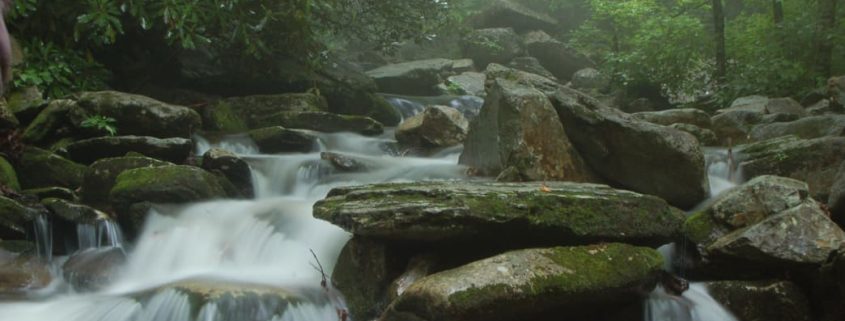
A note on safety: Heed posted warning signs indicating danger and stay on established trails. Never climb on or around waterfalls and never play in the water above a waterfall. Rocks can be slippery and it’s easy to lose your balance especially with bare feet. Currents near waterfalls can be extremely swift even in areas further upstream.
Never jump off waterfalls or dive into plunge pools at the base of waterfalls. Rocks and logs can be hidden beneath the surface of the water. Often waterfall pools have swirling water or currents that can drag and keep you underwater. Even if you have seen other people enjoy playing around waterfalls, be aware they have been lucky to escape unharmed.
Waterfalls are constantly changing with varying water flows and erosion of the rocks around them. The current from one place to the next may be faster than you anticipate and the arrangement of rocks or other debris such as logs in the plunge pool is ever-changing.
https://frugalbackpacker.com/wp-content/uploads/2018/07/smgz8ql780ynnm4leeqz.jpg6961044Frugal Backpacker/wp-content/uploads/2016/04/frugal-backpacker-logo.pngFrugal Backpacker2018-07-23 14:30:002018-07-31 18:29:5210 Must-Visit Waterfalls in Western Carolina