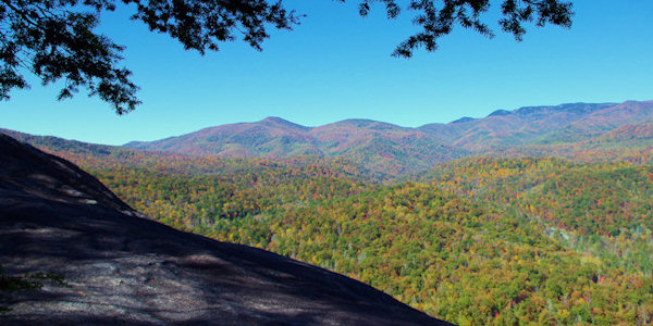
The unseasonably warm weather we’ve been experiencing in WNC this winter has us jonesing for a day on the trail. One of our favorite spots for a long-ish hike with a serious payoff at the end is John Rock. This fairly steep hike to the upper slab of John Rock climaxes in fantastic views, including one of the best views of Looking Glass Rock.
Difficulty: Moderate
Distance: 5 miles
Map: NatGeo 780 Pisgah Ranger District
Location: From Asheville, take I826 east to the exit for the Asheville Airport (exit 40). Turn right onto NC 280; follow the highway for 16 miles toward Brevard. At the intersection with US highways 276 and 64, turn right onto US 276 west (follow signs for Pisgah National Forest). Follow US 276 for 5.2 miles; turn left onto FR 475. Go 1.4 miles to the Center for Wildlife Education and Fish Hatchery. Turn left, cross the bridge and park in the parking lot.


