When I have limited time, but am in the mood for a nice solo hike, I invariably turn to my childhood stomping grounds – the Carl Sandburg home. This lovely gem in Flat Rock offers the perfect balance of solitude and safety, lovely views, and a variety of trail variations for any fitness level. But the hike to the top of Big Glassy Mountain is by far the best view. At 3 miles out-and-back, it’s relatively short, but the hike is pretty much straight up hill, so don’t skimp on proper footwear. This area becomes pretty heavily trafficked in summer, but if you check it out early in the morning, you can still enjoy some solitude.

Difficulty: Moderate

Distance: 3.2 miles

Map: USGS Hendersonville

Location: From Asheville, take I-26 east to exit 53, Upward Road. Turn right onto Upward Road, and continue as it becomes Highland Lake Road, turn right onto Greenville Hwy, and then right onto Little River Road (you’ll see signs for Carl Sandburg National Historic Site), the parking area will be ahead on your left.

To access Big Glassy Mountain, follow the trail toward the main house; .4 miles up, follow the split to the left for the trail to Big Glassy Mountain.

If you love baby animals (and seriously, who doesn’t?), extend your walk a bit by heading straight and checking out the Goat Barn first. If you go in early spring, you’re likely to see newborn kids.

There are few things as romantic as a great day outdoors – stunning overlooks, rushing falls, and the shared experience of overcoming obstacles together. Whether you’re looking to hit the trail with a new crush or your main squeeze, the Asheville area is full of scenic trails long and short, that are sure to fan the flames of romance. Here are 7 of our favorite spots for an outdoor date.

Getting to Know You

  • French Broad River Greenway: This stroll is perfect for new relationships. It’s scenic, yet close to town, well trafficked, and gives you the opportunity to walk as much or as little as you’d like. We recommend meeting up at the Craven Street parking area. Its close proximity to New Belgium and White Duck Taco make it excellent for grabbing a post walk bite or brew.
  • Richmond Hill Park Trail: A close to town option, that offers a more wooded and slightly more secluded feel. Richmond Hill’s trails offer options ranging from a 3.5 mile loop to a short out and back. Wanna switch things up? The park also features a great disc golf course. If things go well, wrap up your date with a cocktail and views of the French Broad at The Bywater.

The Next Level

  • Craggy Pinnacle Trail: Ready to commit to a romantic drive on the Parkway? A 45 minute drive will get you to the parking area of Craggy Pinnacle. It offers sweeping 360 degree views without a lot of effort. The short length of this trail (.9 mile roundtrip) makes it perfect for a sunset picnic. The high elevation means it’s always colder here than you think; don’t forget to bring blankets and hot beverages.
  • Max Patch: Whether you opt for the 1.4 mile short loop or the 2.4 mile loop, this hike on the AT offers some of the best views around. If you’re out that way in April, pack in fresh cookies or other goodies and share a little “trail magic” with passing AT hikers. You’ll have a great day meeting new people, and it’s a surefire way to impress your date.

Getting Real

  • Graveyard Fields: What could be better than an easy hike great views and wild blueberries? How about ending your hike with refreshing waterfall dip? This 3.2 mile hike has it all. Don’t forget to pack a picnic for a perfect day outdoors.
  • Cat Gap Loop and John Rock: This 4.4 mile hike is fairly difficult, so make sure you come prepared with proper footwear and trekking poles. If you and your date are up for the challenge, your hard work will be rewarded with fantastic views of some of Pisgah’s most iconic landmarks. End your day with a pint at Ecusta Brewing and some Hawg Wild BBQ for a perfect day in Pisgah.
  • Graybeard Trail: This lengthy out and back is great for a full day of hiking or a nice overnight. After about an hour and a half on the trail, you’ll encounter a beautiful waterfall. Push another 45 minutes (just past the shelter) for even more fantastic views. If you’re ready for an overnight, there are great campsites near the waterfall and, of course, at the shelter.

JOIN OUR NEWSLETTER

Max Patch is just one of those hikes that everyone should try to do at some point in their life. It is one of the largest maintained balds in the Southern Appalachian mountain range and boasts incredible 360-degree views of equally beautiful surrounding mountains. From the parking area hop on the trail going left into the woods and up towards the summit. Walk along the Appalachian Trail and enjoy views of the Smoky Mountains to the west and the Black Mountain range to the east. Do not use the small footpaths that lead from the peak to the parking area as erosion is causing excessive damage to the hillside.

Difficulty: Easy/Moderate

Distance: 1.4 miles-Variable

Map: NatGeo 782; French Broad and Nolichucky Rivers

Location: From Asheville, drive about 39 miles west on the I-40 to Exit 7 for Harmon Den and turn right on Cold Springs Road. Cold Springs Creek Road then goes 6 miles up the mountain and ends at Max Patch Road, passing thru the Harmon Den area along the way. Follow signs for Max Patch.

JOIN OUR NEWSLETTER

An iconic rock formation in the northern section of Pisgah National Forest, Table Rock is a surprisingly moderate hike and great fun to explore. You will enjoy spectacular views of Linville Gorge and the surrounding peaks.

Difficulty: Moderate

Distance: 2 miles

Map: NatGeo 779; Linville Gorge/Mount Mitchell

Location: From Asheville take 1-40E to Marion and then follow US-221 north to the Linville Falls area. Follow US-183 to US-181 and take 181 for 2 miles to the second intersection with Gingercake Rd. and follow signs for Table Rock on 1264. Continue for 3 miles until you pass the Hawksbill parking area. 5 miles past Hawksbill parking you will find the Table Rock trailhead. Open April-December.

JOIN OUR NEWSLETTER

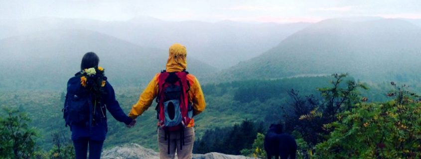
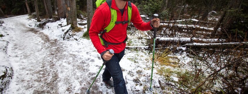
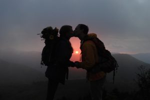
When you live in one of the most beautiful places on the planet with fantastic access to the outdoors, top restaurants, and every type of art there is, for something romantic that’s different from your weekly routine is easy: take a hike!

Melina Coogan

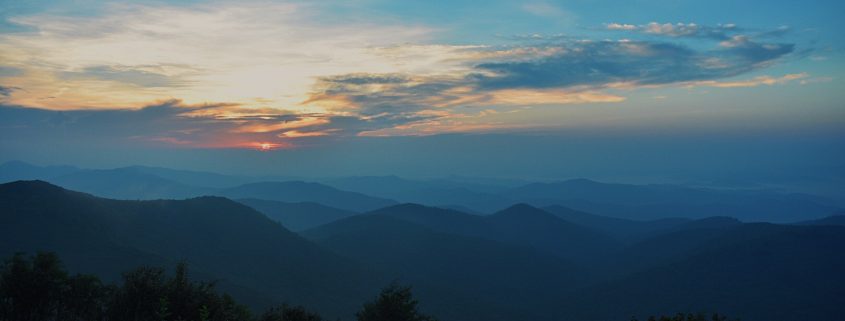
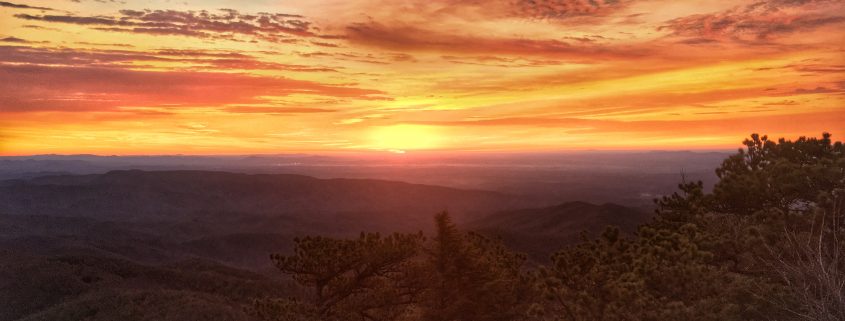
A winter hike offers many rewards for you and your favorite explorer. You’ll appreciate the refreshing temperatures as you climb a mountainside. Many times, you’ll have the trail all to yourself since there are fewer fellow hikers. The best views of the year are on display thanks to leafless trees and deep blue skies. While the higher peaks see snow, valleys have mild winter days perfect to get outdoors. Plus, no bugs mean you’re free to hold hands or snuggle.

Here are five great winter hikes that are close to home:
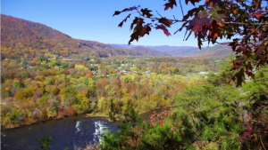
Lover’s Leap

While most of the Appalachian Trail is too remote for winter hikes, you can easily take a “walk in the woods” in this section in Hot Springs. The trail runs along Main Street, so just park and start your hike there. Cross the French Broad River and climb the ridge up to several outcrops for views across the valley and river. On the way back on the 1.5-mile round trip hike, stop for a soak in the hot mineral springs or enjoy one of the restaurants in this charming mountain town.

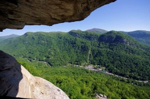
Deep Creek Waterfalls

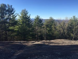
One of the busiest camping and tubing areas of Great Smoky Mountains National Park in the summer, Deep Creek is a lower elevation trail that receives little snow. To see three frozen waterfalls, you have the option of 2.4-mile or 5-mile roundtrip hiking routes. Plenty of seating means you can take your time on this hike that’s just three miles from downtown Bryson City.

Rattlesnake Lodge

While the name may cause hesitation, this 3-mile roundtrip hike is a local favorite on the Mountains-to-Sea Trail. Hike the former carriage road up the ridge to the ruins of an early 1900s summer retreat. February is the perfect time to visit since you can more easily find the stone foundations of many buildings.
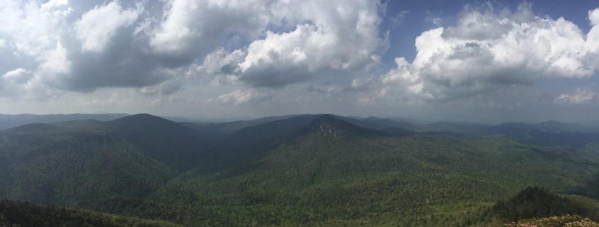
Bearwallow Mountain

Just 19 miles from Asheville is a short hike that rewards with 360-degree views from a treeless summit on the western rim of the Hickory Nut Gorge. Cattle often graze on top, but they will gladly share the meadow with you for a picnic by the historic lookout tower. Carolina Mountain Land Conservancy recently protected the mountain and built the 1-mile trail for all to enjoy. The uphill climb will quickly warm you up!

Mountains-to-Sea Trail at the Folk Art Center

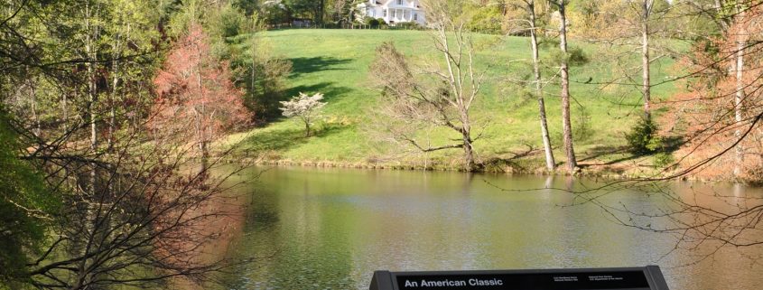
You don’t even have to leave the city of this one! Hop on the Blue Ridge Parkway and follow the signs to the Visitor Center or the Folk Art Center (the trail starts at one and ends at the other). If you want a walk of 5.5 miles, then make it an out and back. If you want a shorter walk, just park a car at each end. This walk is a perfect blend of urban and rural coexistence with lots of features: two tunnels, a bridge over the Swannanoa River, steps, an overpass over US 70, walk under a BRP viaduct, an open field with a picturesque barn, and maybe cows.

JOIN OUR NEWSLETTER

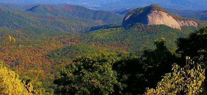
Featured image provided by Melina Coogan

From the parking area for Black Balsam hop on to the Art Loeb Trail and begin your climb to Black Balsam Knob. 400 feet of elevation gain comes quickly and relaxes into a mostly flat hike as you emerge on the bald. Follow the trail north across the picturesque ridgeline until it intersects with the Ivestor Gap trail that with a left turn will take you back to the parking area.

Difficulty: Moderate (Bear Canister Required for Camping) Distance: 0.5-5.5 miles

Map: Nat Geo 780; Pisgah Ranger District

Location: Take the Blue Ridge Parkway south past Mount Pisgah and Graveyard Fields. Past milepost 420 look for the road to Black Balsam. It’s about 0.8 miles on this (semi) paved road to the first parking area and another half mile to the parking area at the end of the road. (the Sam’s Knob and Ivestor Gap trailhead).

JOIN OUR NEWSLETTER

The trail to Hawksbill is 1.5 mile out and back to one of the dominant peaks overlooking the beautiful Linville Gorge. At the summit, you will sit 2000 feet above the valley floor and its winding Linville River. On low haze days you can even spy Charlotte, North Carolina’s skyline. If you have the time and energy afterward you can drive a couple miles down the road and explore Table Rock!

Difficulty: Moderate/Rugged

Distance: 1.5 miles

Map: NatGeo 779; Linville Gorge/Mount Mitchell

Location: From Asheville take 1-40E to Marion and then follow US-221 north to the Linville Falls area. Follow US-183 to US-181 and take 181 for 2 miles to the second intersection with Gingercake Rd. and follow signs for Table Rock on 1264. In 3 miles you will see the parking area for Hawksbill Mountain.

JOIN OUR NEWSLETTER


All you need to do to reach one of the better views in WNC is go on this short hike that climbs to a USFS lookout tower offering 360° views of Pisgah National Forest. From the parking area follow the old gravel roadbed up towards the summit and get your camera ready. Make sure to plan a sunrise or sunset hike to the unforgettable peak.

Difficulty: Easy

Distance: 1.6 miles

Map: NatGeo 780; Pisgah Ranger District

Location: Park at the entrance to the Forest Service Road 450, at Milepost 409.6 on the Blue Ridge Parkway. The road gate is always closed (do not block it). Walk around the gate and begin your hike. This section of the Parkway is rarely open during the winter.

JOIN OUR NEWSLETTER

A brisk trek with friends is one of our favorite activities during the season of staying inside. When a sunny day shines down between bouts of frosty mornings and blustery afternoons, it’s a great time to explore new trails that are harder to access during the warmer months. It’s the perfect prescription to warm you up on those chilly, gloomy days!

As a kid, winter is the season of finding the best spot for sledding, snowball throwing, and snow fort building quicker than anyone else. As an adult, it can be making fresh tracks in the snow or avoiding mud puddles as you check out a view usually obscured by leaves during the spring and summer. There are also few sights that compare to a frozen mountain waterfall and one of the coolest sights to be seen in WNC: needle ice.

There are plenty of rewards to a winter hike including refreshing temperatures, fewer fellow hikers, and endless views of deep blue skies. While higher elevations typically see snow, the valleys around Asheville are usually clear and great on mild days. The North Carolina Arboretum is a great place to explore during these months as sections of the Blue Ridge Parkway are often inaccessible since it’s never treated or plowed.

As with any season, it’s best to be prepared when heading out for a hike of any length. Trail-tested essentials to keep in your daypack year round are water bottles, trekking poles, snacks, first aid kit, and whistle. A headlamp and a rain jacket are also imperative if you like to enjoy too-beautiful-to-miss sunsets or make a wrong turn. This is one season you can leave the insect repellant at home.

With heavier used trails, winter hiking can present packed snow turned slick or slushy mud. Consult with a footwear expert at Frugal Backpacker to choose footwear based on expected trail conditions. Winter hikers usually have better grip and sturdy ankle support. A good pair of hiking boots – no matter the season – provide great piece of mind.

Even though the days seem shorter, there’s still plenty of time to enjoy an afternoon or weekend hike and come back home for a warm bowl of chili or cup of tea. Layer up and get outdoors!

JOIN OUR NEWSLETTER

Photo: Romantic Asheville

There’s no rock structure in the Pisgah Ranger District quite as iconic as Looking Glass Rock. The trail is challenging, but for those willing to brave the lengthy ascent, the views from the top are an ample reward. Exercise caution on this trail and try to plan your visit for dry weather. Trail conditions are less than ideal after a heavy rain.
Difficulty: Moderate/Hard
Distance: 6.4 mi
Map: Nat Geo 780; Pisgah Ranger District Location: From Asheville, NC, take I826 east to the exit for the Asheville Airport (exit 40). Turn right onto NC 280; the highway for 16 miles toward Brevard. At the intersection with US highways 276 and 64, turn right onto US 276 west (follow signs for Pisgah National Forest). Follow US 276 for 5.2 miles; turn left onto FR 475. The trailhead parking area is on the right after 0.4 miles.

JOIN OUR NEWSLETTER