Joyce Kilmer Memorial Forest is a truly special place. Getting there takes some time – about 2hrs, but the opportunity to wander around it’s exceedingly rare old growth hardwood is well worth the trip. Wandering around it’s numerous loop trails, expect to find tulip poplar trees over 100′ tall and 20′ in circumference. This is a true step back in time to what our forests were like prior to the logging boom of the early 1900’s. These breathtaking beauties are particularly spectacular if you can catch them in the fall.

Difficulty: Easy

Distance: 2 miles

Map: NatGeo 781; Ocoee and Tellico

Location: Approx. 2 hours west of Asheville. Take I840W to Exit 27. Exit right onto U.S. 19/74 toward Waynesville. Go about 47 miles, and bear right on NC 28N. Go 5 miles, and turn left on NC 143 to Robbinsville. From Robbinsville take NC 143W. After about 12 miles, turn right on Joyce Kilmer Road (SR1134). Go 2 miles and turn left to memorial forest.

JOIN OUR NEWSLETTER

Photo Courtesy of Romantic Asheville

There are few things as awe-inspiring as watching water rush down a mighty waterfall while you’re enveloped in fall foliage. That’s what makes Crabtree Falls one of our favorite hikes for reveling in WNC’s stunning fall colors.

This rewarding hike sits on the border of the Black Mountain range and the Blue Ridge Mountains and offers a couple of options: a 3 mile out-and-back or a 3.5 mile loop. After following the Crabtree Falls Trailhead to the falls, you can choose to return on the same path or climb the stairs that cross Big Crabtree Creek and follow the loop path along the creek for a 1.7 mile hike back to the parking area. While the loop path is a bit more challenging, we think it’s definitely worth the effort.

Trail: Crabtree Falls
Difficulty: Moderate
Distance: 3/3.5 (loop) miles
Map: NatGeo 779; Linville Gorge/Mount Mitchell
Location: Crabtree falls is at mile marker 339.5 on the Blue Ridge Parkway. Roughly 45 miles north of Asheville you will find the parking area for Crabtree Falls

Be careful while hiking and exercise extra caution around water; keep an eye out for slippery surfaces and wear proper footwear. Always follow our Outdoor Safety Basics.

JOIN OUR NEWSLETTER

If you’re looking for a fun family afternoon in the great outdoors, check out one of our favorite hikes for a summertime splash – Skinny Dip Falls. This short hike to idyllic falls and swimming hole on the Yellowstone Prong of the Big East Fork of the Pigeon River is perfect for a relaxing afternoon and well within the limits of even the littlest of hikers. Cross the road at the parking area and follow the path next to milepost 417 up the hill and follow the Mountains-to-Sea trail straight at the intersection. Enjoy a quick jog uphill and follow the ever-increasing volume of the Yellowstone Prong downhill and prepare to cool off in one of the most popular swimming holes in Western North Carolina.

Difficulty: Easy
Distance:
0.8 miles
Map:
NatGeo 780; Pisgah Ranger District Location: From Asheville, take the Blue Ridge Parkway south past Mount Pisgah and US 276 to milepost 417. Park at the Looking Glass Overlook on your left-hand side. 

JOIN OUR NEWSLETTER

View on the Trail, Courtesy of romanticasheville.com

If a relatively easy hike that still offers some distance and stunning views of rare flora sounds like your perfect afternoon, you’ve gotta check out the Pink Beds Loop hike in Pisgah. Named after the rare pink swamp lily, this fun and relaxing loop wanders around the bottom of a unique valley with rare mountain bog and American beaver habitat. The trail is flat and takes you through beautiful fern-covered woods and huckleberry patches. Visit in the late spring/early summer  and you’ll be able to witness wetlands abloom with pink swamp lilies.

A large covered pavilion and open field near the trailhead make a perfect spot for a post hike picnic or friendly game of frisbee.

Trail: Pink Beds
Difficulty: Easy
Distance: 5 miles
Map: NatGeo 780; Pisgah Ranger District
Directions: From Asheville, take I-240 west to I-26 east to exit 40, Asheville Airport/NC 280. Turn right onto NC 280; follow for 16 miles toward Brevard. At the intersection with US highways 276 and 64, turn right onto US 276 west (follow signs for Pisgah National Forest). Proceed on 276 for 11.4 miles through Pisgah National Forest to the Pink Beds Picnic Area, just past the Forest Discovery Center on the right. The trail starts at the signboard at the back left side of the parking lot.

Photo courtesy of romanticasheville.com.

JOIN OUR NEWSLETTER

We’ve partnered with our friends at Asheville Trails and Diamond Brand Outdoors for the WNC Trail Triple Crown Challenge.

Visit Frugal Backpacker or any Diamond Brand Outdoors location to check out the awesome new Asheville Trails kiosks with dozens of local trails. We believe the outdoors are for everyone of all abilities, so you’ll find lots of good stuff at the kiosk, like directions and insider tips on easy, moderate, and difficult hikes of varying distance. Find a trail you like, and then snap a picture of the info sheet with your phone. And then visit the Asheville Trails website to get driving directions and more trail info.

Hit any three trails from the displays during April and we’ll give you 20% off up to five items, plus a free Asheville Trails sticker! Just post a pic to Instagram while you’re on the trail, tag both @frugal_backpacker and @ashevilletrails, and use the hashtag #WNC3C.

Once you’ve hiked three of the trails, return to Frugal Backpacker or any Diamond Brand Outdoors location to receive your discount. A team member will take a look a look at your tagged photos — which we’d probably like to share on our feed if you give us permission!

Discount cannot be used for gift cards, boats, or special orders. See store for any other exclusions.

The unseasonably warm weather we’ve been experiencing in WNC this winter has us jonesing for a day on the trail. One of our favorite spots for a long-ish hike with a serious payoff at the end is John Rock. This fairly steep hike to the upper slab of John Rock climaxes in fantastic views, including one of the best views of Looking Glass Rock.

Difficulty: Moderate

Distance: 5 miles

Map: NatGeo 780 Pisgah Ranger District

Location: From Asheville, take I826 east to the exit for the Asheville Airport (exit 40). Turn right onto NC 280; follow the highway for 16 miles toward Brevard. At the intersection with US highways 276 and 64, turn right onto US 276 west (follow signs for Pisgah National Forest). Follow US 276 for 5.2 miles; turn left onto FR 475. Go 1.4 miles to the Center for Wildlife Education and Fish Hatchery. Turn left, cross the bridge and park in the parking lot.

JOIN OUR NEWSLETTER

It may be a little hard to imagine layering up for a winter hike with the unseasonably warm weather we’ve seen over the past few weeks, but a chilly trek with friends is one of my favorite activities during the season of staying inside. When a sunny day shines down between bouts of frosty mornings and blustery afternoons, it’s a great time to explore new trails that are harder to access during the warmer months. It’s the perfect prescription to warm you up on those chilly, gloomy days!

As a kid, winter is the season of finding the best spot for sledding, snowball throwing, and snow fort building quicker than anyone else. As an adult, it can be making fresh tracks in the snow or avoiding mud puddles as you check out a view usually obscured by leaves during the spring and summer. There are also few sights that compare to a frozen mountain waterfall and one of the coolest sights to be seen in WNC: needle ice.

There are plenty of rewards to a winter hike including refreshing temperatures, fewer fellow hikers, and endless views of deep blue skies. While higher elevations typically see snow, the valleys around Asheville are usually clear and great on mild days. The North Carolina Arboretum is a great place to explore during these months as sections of the Blue Ridge Parkway are often inaccessible since it’s never treated or plowed.

As with any season, it’s best to be prepared when heading out for a hike of any length. Trail-tested essentials to keep in your daypack year round are water bottles, trekking poles, snacks, first aid kit, and whistle. A headlamp and a rain jacket are also imperative if you like to enjoy too-beautiful-to-miss sunsets or make a wrong turn. This is one season you can leave the insect repellant at home.

With heavier used trails, winter hiking can present packed snow turned slick or slushy mud. Consult with one of our footwear experts to choose footwear based on expected trail conditions. Winter hikers usually have better grip and sturdy ankle support. A good pair of hiking boots – no matter the season – provide great piece of mind.

Even though it seems like spring has come early, there’s still plenty of time to enjoy an afternoon or weekend hike and come back home for a warm bowl of chili or cup of tea. Layer up and get outdoors.

JOIN OUR NEWSLETTER

We’re all too familiar with the winter challenge of trying to squeeze in a quick after-work hike before the sun sets. That’s why we’re always happy to find an enjoyable but relatively close to town hike like Mount Pisgah, that’s. A 3-mile round trip hike to the top of Mount Pisgah provides breathtaking scenery just 30 minutes outside of Asheville.

This peaceful hike climbs through hardwood forests and rhododendron tunnels before topping out to stunning 360-degree views. Despite the transmission tower at the summit, you can enjoy unmarred views of Shining Rock Wilderness, Cold Mountain, The Great Smoky Mountains, and Mount Mitchell. While this hike is relatively short in distance, its somewhat steep and rocky trails provide a decent workout for the time invested. This trail is a popular weekend destination, but we’ve found it to be a quiet mid-week hike.

Difficulty: Easy/Moderate

Distance: 3 Miles

Map: NatGEO 780; Pisgah Ranger District

Location: From Asheville, take the Blue Ridge Parkway south to the Mount Pisgah Parking Area, on the left at milepost 407.6. Park at the second parking area; the first is for Buck Springs trail.

JOIN OUR NEWSLETTER

If you want the reward of a beautiful view without an arduous hike, look no further than Craggy Gardens. A short 1.4-mile hike provides you with postcard-perfect 365-degree mountain views. The views are particularly stunning at sunrise and sunset (don’t forget your headlamp). In addition to great views, the high elevation allows you to spot some unique plant life year round, but our favorite time to hit this hike is in mid-June when the entire rhododendron covered mountainside is in bloom. The hike up is rocky, but fairly easy, and is great for new hikers and children.

Even on cloudy days, the view from Craggy is superb.

Even on cloudy days, the view from Craggy is superb.

Distance: 1.4 miles

Difficulty: Easy

Recommended Map: NatGeo 779; Linville Gorge/Mount Mitchell

Directions: From Asheville, follow the Blue Ridge Parkway North 18 miles past the Folk Art Center. Pass the Craggy Gardens Picnic Area and Visitor Center; go under the Craggy Pinnacle tunnel. Turn left into the Craggy Dome overlook just past the tunnel. Park in the upper parking lot.

Be safe. Play more. Remember our outdoor safety basics.

JOIN OUR NEWSLETTER

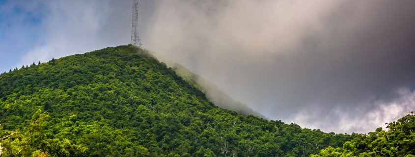
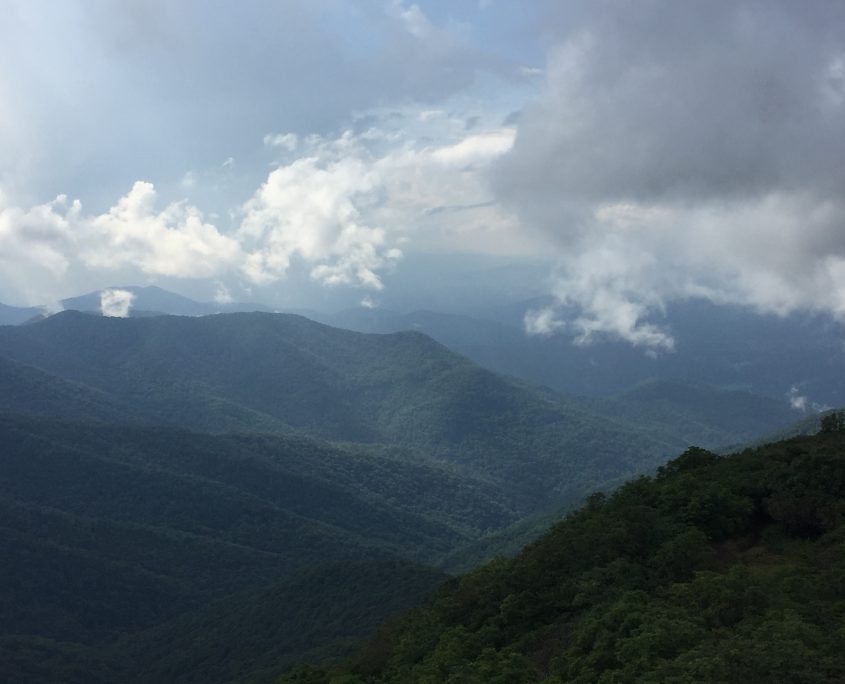
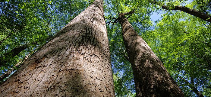
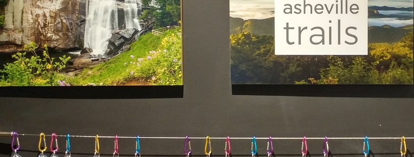
We truly live in an outdoor paradise. WNC offers hundreds of beautiful hiking trails and breathtaking overlooks. But to make the most out of your adventure, it’s vital to be well prepared and think about a few essentials for a rewarding (and safe) experience.

Water:

Always bring along enough water for your hike. An average adult will likely drink a minimum of 2-3 liters of water on a full day of hiking, but will likely need more, especially in warm weather or on particularly strenuous hikes. Good news! Water is plentiful in WNC and delicious! Just bring along a filter, pump, or treatment solution and you will have all the clean water you need.

Rain Gear: 

Rain gear is critical in WNC, one of the rainiest parts of the country! During popular spring, summer, and fall months rain and thunderstorms are a common occurrence. Stay dry, stay warm, stay safe, and play more

Maps: 

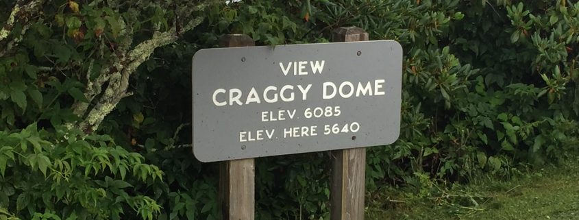
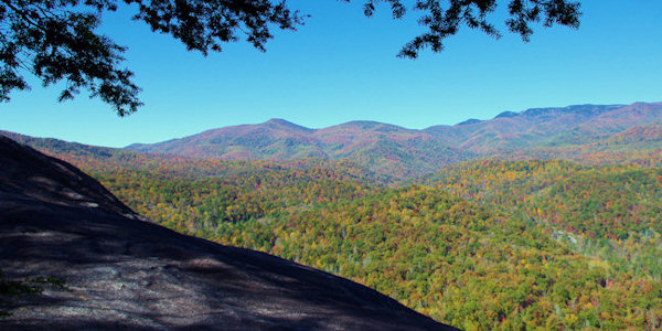
If you’re doing the Art Loeb, venturing into a wilderness area, or just hiking off the Blue Ridge Parkway to explore a new trail, make sure you know where you’re headed and can find your way back! National Geographic and Pisgah Map Company maps are affordable and readily available.

First Aid: 

Whether taking the family to a swimming hole or going on an overnight camping trip, First Aid is important. Scrapes, cuts, bee stings, sunburn and other more serious injuries can and do occur. Be prepared.

Camping: 

Whether hammocking or curling up in a tent, camping is an awesome way to experience the WNC wilderness! Pisgah National Forest has designated campgrounds for easy car access and also allows dispersed camping anywhere in its boundaries. Certain portions of Pisgah require the use of hard-sided bear canisters. Please check their website for up-to-date information or stop by Frugal Backpacker for advice!

The nearby Great Smoky Mountains National Park requires a permit and advance reservations for all backcountry camping in the park. In the busy season these spots go fast, so plan ahead!

Bear-Bagging is a useful skill when camping anywhere in bear country. WNC is home to a large black bear population and even when camping in areas that do not expressly require bear canisters, we suggest bear-bagging your food and other scented products (deodorant, soap, toothpaste, etc). The PCT method of bear-bagging is our preferred system at Frugal Backpacker. If you are unfamiliar with it, drop into the shop and ask one of our experts to demonstrate. All it takes is a bag, some paracord, a carabiner, and a stick!

Leave No Trace and Wilderness Awareness: 

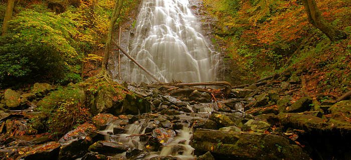
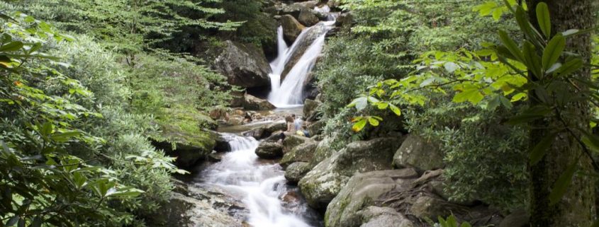
The mountains and forests of WNC are a wonderful resource and welcoming opportunity to learn and explore! Please be respectful of the land and help preserve it for future generations and fellow enthusiasts alike! Bag your trash and carry it out with you. Dispose of human waste responsibly and away from water sources and trails. Thoroughly extinguish any fires and obey fire ban ordinances when and where applicable. Do not disturb wildlife and be mindful of slippery surfaces near the many creeks, rivers, and waterfalls that dot our mountains. More people die from slipping and falling each year than every other cause put together!

If you don’t know, ask! 

Getting into a new activity or learning a new area takes time, but expert guidance can make a huge difference. Stop by Frugal Backpacker or our sister store, Diamond Brand Outdoors and ask our friendly expert staff for info on the local area or gear suggestions. We’re always happy to help!

JOIN OUR NEWSLETTER