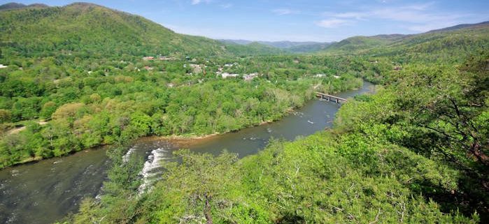
Early settlers who ventured into this tract of land found it so wild they referred to the main valley as “a town of painters.” This town of painters – an ancient Appalachian term for Panthers – has vocally transformed into the modern-day Panthertown Valley. Panthertown’s land has switched hands many times over the years. During the 1920’s a symphony of axes, saws and dynamite-filled the valley as loggers harvested virgin timber. In the 1960’s Liberty Life Insurance purchased the Valley; intent on damming the Tuckaseegee to create a lake resort. Those plans never came to fruition. Lucky for us, the U.S. Forest Service acquired the land in 1989 and placed it under the jurisdiction of the Nantahala Ranger District.
What Makes It Great
Today the valley is home to an intricate network of trails which wind through Panthertown’s unique landscape. Hundreds of millions of years ago forces within the Earth melted mountain d rocks which later cooled and hardened into mountainous “granite plutons”. Over many millennia the forces of erosion have rounded and revealed these towering monoliths within Panthertown Valley. The Valley’s trail system leads visitors by the bases of and to the tops of these rounded cliff-sides.
The Valley has become a popular destination for hiking, biking, climbing and horseback riding. Regardless of the crowds, an escape to serenity is little more than a footpath away in Panthertown. The Forest Service maintains a network of signed trails which most people will instinctively follow. In addition to these “hiking highways,” a labyrinth of unmarked and unnamed “faint-paths and foot-trails” have been developed over the years by a wily group of local enthusiasts.
Venturing out on these lesser known trails can be exhilarating and empowering, but sometimes just plain dangerous. Pick up a copy of A Guides Guide to Panthertown, by longtime Valley enthusiast Burt Kornegay, bring your compass and GPS, mark your divergences, and then go explore!
Who is Going to Love It
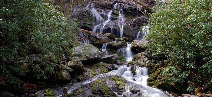
Panthertown’s terrain has created a land of waterfalls which plummet raucously over laurel lined rock faces. Between falls these creeks meander slowly through groves of luscious growth along the valley bottom. Tannins from decaying vegetation in the bogs stain the waters of Panthertown an intriguing tea-color. Sandy beaches and water-carved plunge pools, line the creek banks and offer a reprieve from sweltering summertime temperatures. Come to Panthertown in the heat of the summer, bring your swim gear and take advantage of all the aquatic opportunities in the Valley.
Venture out on the Greenland Creek Trail; work your way up the Creek to see three waterfalls on your way to Tranquility Point, atop Little Green, where you will gain an expansive view of the valley!
Explorers can gain access to the East side of the Valley from Salt Rock Gap Trailhead. Take the Panthertown Valley Trail for a quick viewpoint from Salt Rock, then continue down into the valley to soak up the sun’s rays at the Sandbar Pool!
There is no fee to visit Panthertown Valley and many established backcountry sites are available. Dogs are welcomed but be bear aware, and practice Leave No Trace principles on your visit.
The Boone Fork Trail is renowned not only for the sultry beauty of the mountains it passes through but also the range of ever-changing terrain that one will encounter on this dynamic five-mile loop. The hike begins and ends in Julian Price Memorial Park, a swath of land comprised of 4,200 acres of dense hardwood forest and rolling Appalachian Mountains.
The trail’s namesake river, the Boone Fork, will intersect your path at multiple points along the way, but never with the same temperament. It firsts appears as a flat and docile stream, then transforms over the next few miles into a roaring cascade, tumbling through a garden of cracked granite boulders. As you near the completion of the trail, the river once again becomes placid, cutting through floodplains that, in the summer months, are choked with wildflowers.
Your hike will begin with a gentle climb through soft, undulating hills that give way to cow pastures, meadows and marshes as the din of the river grows and fades in the background. In the heat of summer, you will be grateful for chilled rhododendron tunnels and tall, shady coniferous trees. The gradient for the majority of the trail is moderate, making it a popular loop for trail runners. A few moments of steep climbing, timber cut steps, and one wooden ladder may present a challenge to children, small dogs, and anyone not dressed for the slippery and uneven terrain. Other obstacles include rock hopping, stream crossings, and brief sections of mud.
The pinnacle of this hike is Hebron Rock Colony, a jumble of flat-top boulders so thickly dispersed that the river all but disappears beneath them. This unusual feature cuts into the hillside like an ancient highway, providing an idyllic spot for sunbathing and picnicking. In certain areas, water splashes over granite tongues, creating a natural water park that will prove irresistible on sweltering summer days.
Farther along the trail, rock outcrops provide views of iconic Grandfather Mountain and Hanging Rock. Long range mountains views are secondary, however, to the immediate splendor of a lush, river-fed landscape, wide open fields, and waist-high wildflowers. Not long after embarking from the parking lot, you will find yourself feeling completely immersed in an ethereal beauty reminiscent of a watercolor painting.
Although swimming spots and sunny meadows make this hike a popular excursion in spring and summer, Boone native Ambrose Park advises paying a visit in the offseason as well.
“The Boone Fork trail is awesome, but in the summer you run the risk of crowds,” says Park, warning that on weekends he’s seen people forfeit their hike because they couldn’t find a parking spot. “I like to run it in the fall when there are fewer people and all the colors, and in the winter the river forms all sorts of enchanting icicles.”
To access the trail, cross the footbridge at the Price Park Picnic Area, mile marker 296.4 in Julian Price Memorial Park. Allow yourself three hours of daylight to complete this hike.
Western North Carolina is a land of waterfalls. Countless cascades punctuate the waterways braiding the vast expanses of forest and lofty Appalachian peaks dominating the western corner of the state, lending the landscape an undeniably enchanting quality. Some of the falls are accessible only after delving into wild pockets of backcountry, while others are just steps from the state’s tree-lined byways. With the abundance of waterfalls, narrowing down a short list is a formidable of challenge, but these are among the most stunning cascades adorning the western part of the state.
Located just outside the town of Cashiers, in the Nantahala National Forest, Whitewater Falls is one of the most awe-inspiring cascades in waterfall-laden western North Carolina—and it has the notable distinction of being the loftiest waterfall east of the Rocky Mountains. The mighty cascade announces itself in rushing roar audible from the trailhead for the half-mile path to the overlook for the 411-foot waterfall. A second, lower view platform, accessible after a descending a steep set of stairs, provides another perspective of the falls, highlighting the sheer scope of the towering flume.
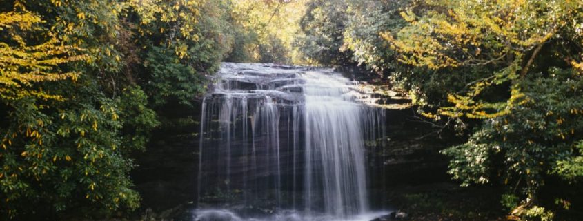
Schoolhouse Falls
Schoolhouse Falls are accessible via a 1.4-mile hike.
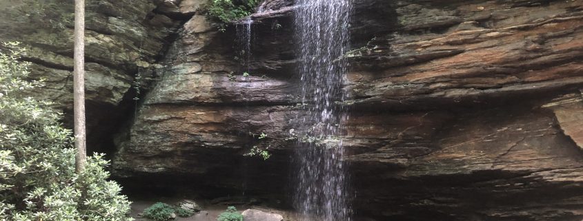
Schoolhouse Falls is located in a stunningly wild corner of the Nantahala National Forest known as Panthertown Valley. Even though the hike is fairly brief, stumbling upon Schoolhouse Falls feels like a foray deep into the backcountry. The 25-foot waterfall spills in a broad flume, pouring into a tannin-tainted plunge pool turned swimming hole during spring and summer. The falls are accessible along the Panthertown Valley Trail via a 1.4-mile hike from either the Cold Mountain trailhead, on the eastern side of Panthertown Valley, or a 2.4-mile hike from the Salt Rock Gap trailhead, on the western edge. Be sure to be prepared for the rugged hiking in the area with a reliable map.
South of the town of Cashiers, in the Nantahala National Forest, Silver Run Falls is a popular summer retreat. Compared to some of western North Carolina’s lofty cascades, the 25-foot drop of Silver Run Falls may sound uninspiring. But the broadly spread wall of water spills into an idyllic swimming hole that’s bordered by sizeable stepping stones, providing a unique access to view the falls. The trek to Silver Run is equally restorative—the falls are accessible courtesy of a quarter-mile trail beginning along North Carolina Highway 107.
Mingo Falls
Mingo Falls descends 120 feet in a narrow cascade.
Just outside the boundary of the Great Smoky Mountains National Park within the confines of the Qualla Boundary (and not far from the town of Cherokee), Mingo Falls is a thin but lofty flume. The nearly 120-foot cascade consists of a series of slender strands of water, all of which funnel together just before tumbling into a pint-sized pool in Mingo Creek. The falls are accessible courtesy of a brief but stair-filled climb of about a half a mile to a footbridge at the base of the cascade, accessible from a trailhead located on Big Cove Road.
Glen Falls
A tiered trio of cascades, Glen Falls tumbles over a broad, rocky section of the east fork of aptly named Overflow Creek, which is located in the Nantahala National Forest just outside the town of Highlands. A scenic but strenuous round-trip hike of about 2 miles on the Glen Falls Trail leads to the collection of cascades, with views of Blue Valley early in the trip. The top tier of the falls, which tumbles nearly 70-feet, is visible from an observation area just half a mile down the trail, and the second significant portion of a falls, a wide, 60-foot flume, appears another quarter mile down the trail.
Rufus Morgan Falls
The 60-foot Rufus Morgan Falls is located just outside the town of Franklin. Alan Cressler
Tucked away in a wooded cove in the Nantahala National Forest just a few miles outside the town of Franklin, Rufus Morgan Falls seems much farther removed from any traces of civilization. The 60-foot partially rhododendron-shrouded flume falls flatly over a craggy cliff face and seems to tumble almost unexpectedly out of the thickly grown forest. Despite the isolated feel, the falls are easily accessible after a leisurely, half-mile hike on the Rufus Morgan Trail.
Tom’s Branch, Indian Creek Falls, and Juney Whank Falls
These three waterfalls are In a southern corner of the Great Smoky Mountains National Park, not far from the Deep Creek entrance. Tom’s Branch and Indian Creek Falls are easily linked on a brief out-and-back hike. Tom’s Branch, the loftier of two flumes, falls 60-feet, stair stepping a weathered rock face. It will emerge after only about a half a mile hike on the Deep Creek Trail, one of the first pathways in the national park constructed by the Civilian Conservation Corps during the 1930s. Barely a quarter of a mile later, after the junction the Indian Creek Trail, the second cascade appears—the 25-foot Indian Creek Falls.
After taking in the first two falls, tack on a trip of Juney Whank Falls. The trailhead for the Juney Whank Trail is also located in the Deep Creek area of the park, adjacent to the starting point for the Deep Creek Trail. Juney Whank Falls, a slender shimmering ribboning falling for nearly 90-feet in two distinct sections, appears after just half a mile on the Juney Whank Falls Trail.
Just a couple miles outside Highlands, Bridal Veil Falls is one of the few waterfalls in western North Carolina visitors can drive to—and even behind. The cascade is accessible directly from U.S. Highway 64 along a stretch North Carolina’s 98-mile Waterfall Byway. Created by a drop in the Cullasaja River, the falls thin out while spilling over a prominent rock ledge, which juts out far enough people—and even vehicles—to perch behind the plunging flume and admire the tumbling water from underneath.
A note on safety: Heed posted warning signs indicating danger and stay on established trails. Never climb on or around waterfalls and never play in the water above a waterfall. Rocks can be slippery and it’s easy to lose your balance especially with bare feet. Currents near waterfalls can be extremely swift even in areas further upstream.
Never jump off waterfalls or dive into plunge pools at the base of waterfalls. Rocks and logs can be hidden beneath the surface of the water. Often waterfall pools have swirling water or currents that can drag and keep you underwater. Even if you have seen other people enjoy playing around waterfalls, be aware they have been lucky to escape unharmed.
Waterfalls are constantly changing with varying water flows and erosion of the rocks around them. The current from one place to the next may be faster than you anticipate and the arrangement of rocks or other debris such as logs in the plunge pool is ever-changing.
https://frugalbackpacker.com/wp-content/uploads/2018/07/smgz8ql780ynnm4leeqz.jpg6961044Frugal Backpacker/wp-content/uploads/2016/04/frugal-backpacker-logo.pngFrugal Backpacker2018-07-23 14:30:002018-07-31 18:29:5210 Must-Visit Waterfalls in Western Carolina
The Blue Ridge Mountains are a paradise in the summer, alive with flowers and fireflies. But the blazing heat can sometimes feel brutal, driving many people indoors to the comfort of air conditioning. There’s no reason to stay cooped up when so many trails offer a respite from the soaring temperatures. Tucked inside the shade of rhododendron tunnels, deep within hardwood forests, and carved alongside roaring rivers, these six refreshing summer hikes allow you to beat the heat while savoring the full splendor of the season.
1. Big Laurel Creek
A rejuvenating creekside hike just 45 minutes outside of Asheville, this even, easy trail along Big Laurel Creek is very popular among locals. The trail is seven miles in its entirety, taking an average of 3.5 hours there and back, although hiking a shorter segment would still be a worthwhile excursion. The best part of your day will be the deep, aquamarine swimming holes that appear occasionally in the Big Laurel River, as well as the cooling mist and sunlit rainbows that arise from trailside waterfalls.
2. Boone Fork Trail
Waterfall alongside the Boone Fork Trail.
Joe Giordano
The heavy shade of rhododendron tunnels and a multitude of river crossings make the Boone Fork Trail the ultimate summer hike of the High Trail. This should be your top pick if you are looking to head out of Asheville and explore the Appalachian region for an entire day. This 5-mile loop in Julian Price Memorial Park outside of Boone, North Carolina, is renowned for the variety of terrain that it passes through, which includes coniferous forest, open pastures, boulder gardens and floodplains filled with wildflowers. Slick river rocks, creek crossings and one cut-timber ladder add a touch of challenge to the ever-changing landscape. Don’t forget to cap off your day with a summer ale at Appalachian Mountain Brewery.
3. Four Falls
Bridal Veil Falls
Melina Coogan
The nine-mile Four Falls Trail in DuPont State Forest provides a show-stopping tour of the area’s most dazzling mountain waterfalls. This spectacular loop will lead you to the base of Triple Falls, High Falls, and Bridal Veil Falls, and alongside the shoreline of cool, placid Lake Imaging. The hike concludes with a quick out-and-back jaunt from the trailhead to Hooker Falls, one of the most popular swimming holes in the Blue Ridge Mountains. Between waterfalls, the trail winds through deep woods and shaded rhododendron tunnels, providing relief from the relentless summer sun. Park at the Hooker Falls trailhead.
4. Craggy Gardens
The view from Craggy Gardens.
Parke Ladd
Due to the elevation, the temperature atop Craggy Gardens is about 5-20 degrees cooler than it is in Asheville. Slabs of slate gray rock and bright pink rhododendron blooms create a vivid landscape, surrounded by panoramic 360 views of Asheville, Mt. Mitchell, and the endlessly undulating Blue Ridge Mountains. A mere 1.4-mile loop, this is a great starter trail for kids: quick, steep without being overly demanding, with a dramatic mountaintop finale that’s perfect for picnics. This hike could be combined with other attractions on the Blue Ridge Parkway such as Graveyard Fields and Skinny Dip Falls for a full day of warm weather exploration.
While we would be remiss to not mention Max Patch as a breathtakingly beautiful summer destination, we’ll concede that its immense popularity could be a deterrent for many hikers. The solution? Visit this enormous Appalachian meadow at night, when the masses have gone home and the sky is so illuminated with lightning bugs that you can capture their glow on camera using a long exposure, as you would the constellations. Pack a blanket for some summer stargazing directly up the hill from the parking area, or enjoy the cool evening air with a moonlit hike on the Appalachian Trail.
6. Daniel Ridge Loop Trail
Toms Spring Falls
Johnny Dickerson
Those of us who love pouring over a good, old-fashioned map may be confused by the name of this four-mile trail, which is actually located on a spur of Lanning Ridge. Misnomers aside, the Daniel Ridge Loop Trail is a lovely and scenic hike which meanders through 50-year-old hardwoods and bucolic pastures enveloped inside the Pisgah National Forest. Sections of steep hillside provide a good workout, but a thick canopy of hemlock and arching mountain laurel dapples and deflects the full glare of the midday sun. The end of the trail crisscrosses over a roaring creek on a series of planks and wooden bridges until it reaches the base of the monolithic, 100-foot Toms Springs Falls.
https://frugalbackpacker.com/wp-content/uploads/2018/07/isc12bwaa5d8so89blag.jpg5871044Frugal Backpacker/wp-content/uploads/2016/04/frugal-backpacker-logo.pngFrugal Backpacker2018-07-23 02:15:372018-07-31 18:32:376 of the Best Summer Hikes in Asheville
With steep cascades as far as the eye can see, Catawba Falls is one of WNC’s best examples of stunning waterfalls. The fairly gentle 1.5-mile climb to the falls runs alongside a stream and offers beautiful scenery the whole way. Plenty of still pools along the trail offer abundant opportunities for a mid-hike splash.
Difficulty: Easy
Distance: 3 miles out and back
Directions: From Asheville, take I-40 E to Old Fort Exit 73. Take a right onto Catawba River Road, after 3 miles, the road ends in the parking area for Catawba Falls.
As summer temps heat up, we’re always looking for refreshing hikes to help beat the heat. Moore Cove Falls offers beautiful scenery, solitude, and a great spot to cool off. You can even walk behind the cascading falls – how cool is that?
Distance: 1.5 miles out and back
Difficulty: Easy
Directions: From 276 at the entrance of Pisgah Forest, head north about 6.5 miles and pull off onto the paved parking area on the right. The trail is not marked with large signage, but there is an info board that will indicate that you’re in the right spot. The trail starts on the wooden bridge to the side of the info board.
At Frugal Backpacker, we believe that the outdoors are for everyone — and we love helping our community discover new places to get outdoors. To celebrate the arrival of summer, our local experts have put together a list of their favorite hikes, from easy to challenging. Make this your most active summer yet (and save on some new gear) by taking the Summer Trail Challenge.
Hit six of our 14 favorite trails before September 23 (the first day of fall), and you’ll get 25% off up to six items.
Just stop by any Frugal Backpacker or Diamond Brand Outdoors location, grab a free sticker, or purchase a logo water bottle, hat, or tee. Take a pic showing off your Frugal Backpacker swag on the trail and post it to Instagram or Facebook with the hashtag #AVLSummerTrail. Make sure to tag @frugal_backpacker and @diamondbrand_outdoors. (Be a good steward and skip any urges to actually stick a sticker on a sign, tree, or anything else that doesn’t naturally have a sticker.)
Once you’ve hiked six of the trails, return to any Frugal Backpacker or Diamond Brand Outdoors location to receive your discount. A team member will take a look a look at your tagged photos — which we’d love to share on our feed if you give us permission.
On those days when you’d like to get a decent hike in, but don’t have time to head too far out of town, head to the Bent Creek area and give this gentle loop a try.
Difficulty: Easy
Distance: 6-mile loop
Map: USGS Bent Creek and Skyland
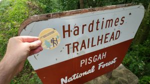
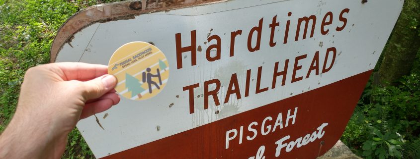
Directions: From Asheville, I-26 East and take Exit 33 onto NC 191. Turn right to head south on NC 191 for two miles. Turn right onto Bent Creek Ranch Road, following the signs for the Lake Powhatan Recreation Area. The parking area at the Hardtimes trailhead is just around two miles down this road on the left.
From the parking area, head through the gate and start down the road. When you reach a canal, cross over to continue on Hardtimes Road. After an easy climb, the trail will briefly meet up with the Mountains to Sea trail, make sure to continue on the Hardtimes trail after the MTS veers back off to the right. Before you reach the parking area for the Arboretum, turn off onto the Old Mill Trail to the left, this will take you through the Arboretum. When you reach Bent Creek Road, turn left and continue out of the Arboretum. Continue to follow this road till you return to the Hardtimes parking area.
With its namesake springs and abundance of incredible hikes, Hot Springs is the perfect spot to sneak away to for a daycation. Of course, the perfect way to start a day in Hot Springs is with a hike to Lover’s Leap, a stunning rock outcropping along the AT. At around 2 miles, it’s a fairly quick hike, but you’ll want to build in some extra time to enjoy the incredible views.
Distance: 2-mile loop
Map: USGS Hot Springs
Difficulty: Easy-Moderate, the trail itself is fairly easy, but does feature some steep spots.
Directions: From downtown Hotsprings, take Bridge Street over the railroad tracks and continue to cross over the French Broad. Immediately after the crossing, keep right and head down the steps to continue on the AT. After about 50 yards, you’ll cross a small wooden bridge, continue along this path following the white blazes. At the top of the ridge, you’ll come to a series of 3 rock outcroppings, the second is Lover’s Leap. After the third outcropping, you can extend your hike by continuing on the AT, or turn left for the Silvermine trail, that will take you back to where you began.
If a serene hike through hardwood forests, alongside a mountain stream, sounds like your perfect summer day, give the Coontree Loop trail a try. Since the trailhead starts at a great picnic area, it’s perfect for a morning hike followed by an afternoon of picnicking and grilling along the Davidson River.
Distance: 3.7-mile balloon
Map: USGS Shining Rock
Difficulty: Moderate
Directions: From Brevard, take 64E to US 276N, Coontree Picnic Area will be 6 miles ahead on the left. After parking, cross back over 276 alongside the small stream on the east side of the parking lot. The blue-blazed Coontree Loop trailhead will be ahead on the left.